Luis Feliu
Byron Shire Council has called on the state government to defer any dredging of the Brunswick Heads boat harbour and navigation channels, and will refuse to allow council’s boat ramp to launch the dredge vessel till questions on the works have been answered.
Council yesterday moved an urgency motion calling on lands and water minister Niall Blair to answer questions about the controversial dredging works, scheduled to start later this month.
Concerns have been raised by councillors that the process in approving the dredging works is very flawed and locals, including boaties, say it’s a massive waste of taxpayer money which will not help improve navigation safety.
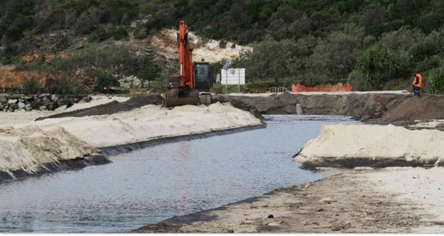
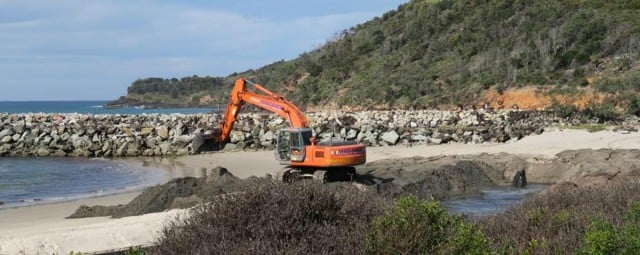
Under the $600,000 plan, dredged sand and sludge from two sections of river channel is to be dumped on the southern end of New Brighton beach via an interim pipeline, while slurry from the harbour will be bagged and trucked out for disposal at a landfill site.
Similar works started last month at the Evans River and boat harbour at Evans Head, which has also sparked concerns by locals there, and more recently in the Clarence River and Iluka boat harbour, all under a multi-million-dollar Crown Lands (NSW Trade and Investment department) program.
Mr Blair is due to announce the Brunswick Heads project details and successful dredging contractor soon.
Yesterday, Byron councillors (except National Party-aligned Crs Diane Woods and Chris Cubis) voted to write to Mr Blair seeking deferment of any dredging works until a series of questions on the impacts of the works were answered.
They said permission to use council’s boat ramp to launch the dredge vessel would not be granted ‘until support has been gained through council resolution’.
The questions put to the minister were:
1. Purpose of Works:
i. As works haven’t occurred for over 20 years, is work proposed ‘maintenance’ or new?
ii. If considered maintenance, what ongoing maintenance is proposed?
iii. What are estimated ongoing costs to maintain the assumed benefits?
iv. Has the stated purpose to “enable safe boat passage” and “address public safety and environmental risks associated with shallow depths causing vessels to run aground” been assessed and supported by evidence? What are the specific measurable triggers that are being applied? Are there documented reports of any accidents and/or injury as a result of shallow waters? Has there been any effort to implement signage in the river indicating the deep channel areas and speed limits?
v. Is the area concerned currently un-navigable? Is there evidence of this?
2. Impacts of Works:
i. Did the REF consider cumulative impacts of ongoing or recurrent dredging?
ii. What modelling has been used to consider the rate of natural sand replacement, and at what regularity is proposed for the ongoing maintenance.
iii. What documentation exists to support the selection of the three proposed dredging sites?
iv. Have immediate and ongoing impacts on sea grasses been considered?
v. Are there any potential nearby geomorphic disturbances identified, such as heightened erosion or accretion?
vi. What are the specific measurable triggers that are being applied to effects of works, natural sand replacement processes and environmental disruptions?
vii. Has a cost-benefit analysis been completed that incorporates environmental and social considerations?
3. Impacts of Works on Fishers and other Users:
i. What commercial fishing benefits have been identified and what evidence has been produced for justification?
ii. What evidence exists to illustrate any current navigation impediments to commercial fishers due to the current state of the river?
iii. Have impacts of dredging for recreational fisherman been assessed?
iv. What assessment has been conducted, and evidence provided, to verify the claimed benefits for local economies and tourism industries?
v. Does this assessment include possible negative impacts due to ecological and marine disturbance?
4. Wider support for Works:
i. Does OEH support the work and agree with the necessity?
ii. Does Marine Parks support the work and agree with the necessity? Does Marine Parks have concerns and have these concerns been investigated? What are the strategies being put in place to overcome articulated areas of concerns?
iii. Has the local Tourism organisation been consulted? Do they agree with the stated need for the dredging?
iv. Has the REF been exhibited for public comment?
v. Has community sentiment been assessed and considered supportive of the proposed works and the needs as stated of them?
vi. Is the Minister satisfied with the level of community consultation and community support?
Brunswick Heads resident Martin Jones told Echonetdaily this week that the community should have been consulted before scheduling the works and there was no evidence of boat users’ safety affected by shallow waters in low tides.
‘Crown Lands claim it’s for the safety of boat users at low tide. But they have not offered any reports or evidence of there being any injuries or accidents because of shallow waters,’ Mr Jones said.
‘In fact boat owners have navigated the river around the tides for 20 years. If they were concerned about safety they would put some speed signs up and markers for channel navigation. And it would cost a lot less (than the millions of dollars being spent).
(See yesterday’s story at https://www.echo.net.au/2015/07/brunswick-heads-boat-harbour-to-be-dredged/)

Evans River dredging
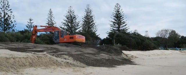
Meanwhile at Evans Head, local Dr Richard Gates told Echonetdaily that the current dredging operation there involved dumping spoil onto the main beach from the north side of the north break wall to several hundred meters to the north of the surf club.
‘The problem is that the sand will be picked up on incoming tides and washed out along the break wall and back in to the Evans River,’ Dr Gates, vice president of the Evans Head Residents for Sustainable Development Inc, said.
‘The locals call this current the “Evans Head Express” and use it with very little paddling to get out to the waves,’ he said.
Dr Gates said that some years ago, after a local fish and bird kill in the river and surrounds, Richmond Valley Council wanted to dump effluent from the local sewerage treatment plant into the river, ‘an incredibly dumb idea’.
He said the community investigated local current movements and found that the effluent would not just flow out to sea but would wash back onto the beach on an outgoing tide.
Local businesses, many relying on tourism, he said, were ‘really bloody cross’ and backed community calls to stop the dumping.
‘Council soon pulled its head in and withdrew the idea but then insisted that we should have an ocean outfall, and many hundreds of thousands of dollars later, abandoned that incredibly stupid idea too.
‘So the evidence we obtained at the time and the currents you can observe now would suggest that the dumped spoil on the beach will eventually wind up in the river in the same places as before, a big waste of money.’

‘Quite apart from the ‘revolving door’ sand problem there is also the problem of the spoil being dumped onto the beach.
‘The current spoil is being removed from the area near the old slipway and the channel leading to the boat harbour. I note that the spoil is very dark and quit sludge-like.
’It is running into the ocean from the main surfing beach and then it takes the “Express” back out into the ocean and into the river.
‘I watched the activity throughout the day and took many photos and videos to show flows. I didn’t see anyone collecting samples for analysis and monitoring which, in my view, should have been done!
‘I am hard-pressed to understand why dredging is going and why it appears to be digging in to the rock base in the river.

‘If this is all being done to support the annual fish kill at Evans Head in the name of safety and business creation, it is a very bloody expensive exercise, when the same could be better spent on other more urgent work including repair of the riparian vegetation along the Evans River from the Bream Hole to Kalimna, a park near the slipway.
‘Most of the vegetation is now gone courtesy huge engineering works executed to fix a subsidence problem caused by years of council neglect of storm water flows, natural springs and willful destruction of riverbank vegetation to enhance local views.
‘Despite the big bucks spent there are still significant problems for the river including lack of storm water management before it hits the river.
‘No wonder 90 per cent of our river sea grasses are gone and river fishing is a shadow of its former self,’ Dr Gates said.
Contamination?
He said his main concern ‘is the quality of the spoil and where it is being dumped’.
‘There is clear evidence that the liquid from the spoil is running into the ocean almost opposite the surf club. It then runs south to the breakwall and then out into the ocean near the river mouth along what is called the Evans Head “Express”, a rapid current run alongside the breakwall which surfers use to get out into the surf with minimal effort. I have video footage of this process.
‘On the incoming tide I expect the spoil liquid will run back into the river as usually happens. This is at odds with what is shown in the documents accompanying this dredging program.
‘There are three questions which, in my view, need to be asked:
‘1. What testing is being done of the spoil with regard to contamination given that the bottom of the river is being dredged near the end of the old slipway. Who is doing the ongoing testing? I saw no-one from a govt department monitoring the process.
‘2. Why is the dark solid spoil being dumped further out from the new sand ‘wall’ than other lighter sand? Is the intention for it to be washed away on the high tide so that any potential contamination is washed away?
‘3. Whose idea was it to dump spoil in this area given the known history of current flows back into the river on the incoming tide which will take sand back into the river?’


The follies of “centralized” decision making writ large – Local government needs to wrest back planning & development powers from the state government. The balance has swung too far away from people who actually know what is going on.
Good article Echo and comment from Liz.
So on one hand there’s support for our councillors to make decisions on issues such as dredging Brunswick Heads boat harbour and navigation channels, yet on the other hand we want to stop them making decisions on erosion preventative initiatives such as rock walls?
That’s what I love about Byron – we’re a contradiction in motion.