By Luis Feliu
Managers of crown foreshore holiday parks in Brunswick Heads will explain their new management plans for the town’s three parks, and adjoining public land, at guided tours for residents next week.
The plans, endorsed by Byron Shire Council just before last September’s election, sparked some concern by foreshore protection and community campaigners, which park management has moved to allay with the consultation sessions on Tuesday.
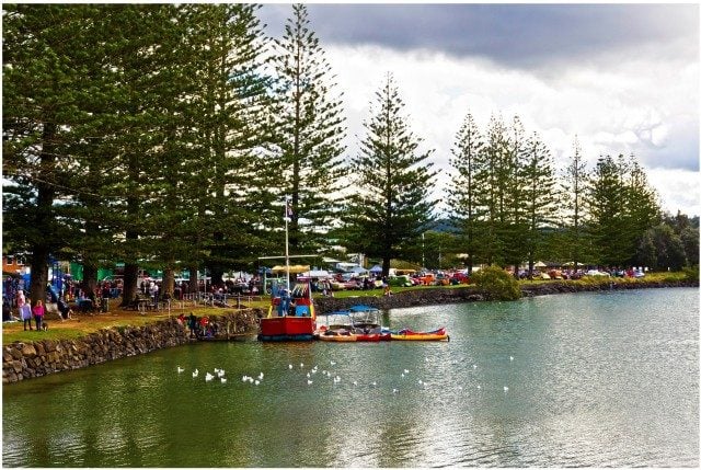
Walk-through tours for locals registering with the NSW Crown Holiday Parks Trust (NSWCHPT) will be held through Ferry Reserve, The Terrace and Massey Greene parks from 9am till 4pm.
The sessions come as trust managers dispute claims by the Foreshore Protection Group that public land adjoining park boundaries will be used for operational (commercial) gain by the holiday parks and that the required 10-metre setback from local foreshores will be preserved for public use.
They fear the adjoining public land will be opened up to commercial activity, while locals are closed out of foreshore parks during busy holiday periods. (See previous story at https://www.echo.net.au/2016/10/bruns-crown-parks-decision-overturned/)
But Trust CEO Steve Edmonds told Echonetdaily council’s decision in August endorsing the new management plans and proposals ‘actually preserves the 10-metre setback’.
Mr Edmonds said that in order create the 10-metre setback, residents at The Terrace Holiday Park would be relocated by the trust and at Ferry Reserve, the foreshore sites would also all be moved to create the 10m setback.
He said the trust was going through a costly process trying to ensure they ‘get it right’ and gain the community’s trust.
Mr Edmonds also said no commercial activity for the parks was planned and the adjoining land was public open space.
But an FPG spokesperson said The Terrace Reserve (adjoining the Terrace Holiday Park), was now endorsed in the plans as in the park’s operational boundaries, and therefore able to be used for commercial gain by the trust.
FPG spokesperson Michele Grant said the Terrace reserve’s southern section was ‘never part of the caravan parks’.
She said the community was not opposed to the park being licensed to use it for overflow low impact (tents etc) camping at Christmas and school holidays but not closed off to the public.
The southern section ‘was only taken by park management’ after council was dismissed by the state government from running the parks in 2006.
‘This opened it up for 24/7 use and change of use, the historic war memorial pines there were savaged to bring in huge caravans and mobile homes, it was open space and public recreational area adjoining the correct operational boundary of the caravan park.’
While Mr Edmonds accused Echonetdaily of ‘misinformation’, FPG members say the trust maps on the proposed new foreshore boundaries were not clearly identified and proposed cabins for Massey Greene also were within the 10-metre setback.


NSW Crown Holiday Parks Trust (NSWCHPT) is embarking on a community consultation exercise on 8 November through the caravan parks in Brunswick Heads. During the proposed walkabouts NSWCHPT will be giving information about their draft proposed amendments to the Plans of Management (POM) for the caravan parks. Those who have registered for the sessions need to be prepared with meaningful questions as opposed to outrightly accepting their development ‘concepts’ to take prime foreshore parkland into their commercial operation.
I would strongly urge participants to ask that the following be identified on any maps, or better still ground-truthed during these walks and questions given substantive answers.
1. Where are the boundaries of the Crown Reserve?
2. Where is a clearly defined foreshore boundary for each of the caravan parks shown on the maps?
3. Where are the boundaries for the area that NSWCHPT want for their commercial operations?
4. Where are the boundaries that Council determined?
5. Why is NSWCHPT ignoring/dismissing Council’s legislative power to determine the operational boundaries and conditions of operation?
6. Why is the 10m setback from a foreshore boundary been ignored in Massy Greene?
7. How is public access to be maintained to the public boat ramp at Ferry?
8. Why is NSWCHPT refusing to leave the grassed foreshore area at Ferry as shared open space for the general public and caravan park clientele?
9. Why at the Terrace has park management continued to ignore a tree management strategy to date for the WW1 Memorial Coastal Cypress Pines, part of a colony of Threatened and Endangered Species when it was known since 2010?
10. What time frame is given for the reinstatement of the buffer zone/unfettered walkway along the top of the riverbank of Simpson’s Creek? How does this compare to the time frame already given in Council’s resolutions?
11. Is the 3m buffer zone inside the operational boundaries and if so what are the implications in the event of sale/leasing of the caravan parks?
12. How and when is the feedback to be reported upon and on what criteria and by whom, is feedback to the proposed amendments included in the preparation of the Plans of Management?
Steve Edmonds fails to acknowledge new additional road reserve lands including Riverside Crescent at Ferry Reserve and part of Terrace road (along the one way strip) were acquired by Crown Lands in 2012 along with Lot 7005 which was part of the Harbour Precinct (acquired in 2009). None of these areas were previously included within the operational area of the caravan parks and the road reserve lands & Lot 7005 are grassy areas that form part of the existing foreshore.
Mr. Edmonds plans include these additional lands within the operational area of the parks in Ferry & Terrace parks. Along the western boundary of Massey Greene and the yacht precinct there is less than 10m remaining for public use with all of Lot 7005 now within the holiday park boundary. Proposed cabins are not setback 10m from the riverbank in Massey Greene.
The concept drawings provided by Mr. Edmonds do not provide clearly identified foreshore boundaries (is the public walkway outside the caravan park or within the operational boundaries?)
The drawings are not properly surveyed maps that accurately indicate measurements for setbacks and buffer zones or site allowances.
The drawings fail to identify areas where the holiday parks will be extending their operational boundaries onto adjoining public lands.
The information provided is woefully inadequate as a planning document and once again we are expected to seriously and sensibly discuss boundary adjustments using Crown Lands cartoons – not real ground-truthed surveyed plans.
Patricia and Michelle,
This land is Crown Land, a Crown Reserve, meaning the land belongs to the people, the ratepayers of Byron Shire and to be managed by their representative, Byron Council.
For any bare ground to have any sort of development on it, the surveyors are sent in to survey the land and to set boundaries. The boundaries are the LEGAL requirements of the development on the ground itself and on a Plan. Therefore where there are no defining boundaries, there is no legal basis for the caravan parks to be there on that land and they could be on that Crown land illegally. Should the police be there today?
If there were boundaries they would be defined by the caravan parks on a Plan as well in the ground by Survey Pegs. No survey pegs means there are no boundaries and therefore the caravan parks do not legally exist as a business. Boundary pegs and boundary lines are the legal basis for Council to let the business be there as a going concern on land that belongs to the ratepayers of Byron.
It’s not hard to see what is going to happen. Just take a look at Evans Head where the crown reserve fronting the river has been turned over to the caravan park. Nobody minded when this was confined to the summer holidays. But now morning day or night, if you walk around the foreshore you basically promenade through a caravan park. All the tourist’s chairs are directed towards the water and as you walk on the narrow path between the tourists and the river their gaze is directed on you. After a few evening brews they tend to get a bit chatty. That s where these proposals will inevitably lead. So If you enjoy a quiet evening stroll you had better get your butt in gear and oppose these proposals or else that simple pleasure will soon be gone forever.
The bottom line is that you should not listen to the caravan park owners. They will say anything to ensure that the communities land is turned over to their business interest. Wouldn’t you do the same if you owned the caravan park?
What is your advice Peter to those whose simple pleasure is to enjoy an evening stroll and also to enjoy chatting with the park residents?