


The NSW State Emergency Service has advised Northern Rivers residents to monitor conditions for possible flash flooding after more than 117mm of rain fell at Cape Byron and Ballina Airport over four days, with further falls overnight.

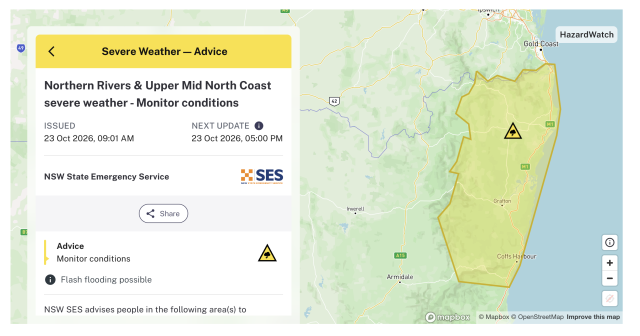
The latest advice, issued at 9.01am today (Friday, October 23), covers the Northern Rivers and Upper Mid North Coast.
It identifies flash flooding as possible and urges people to ‘Monitor conditions’. A further update is scheduled for 5pm today.
Bureau of Meteorology observations show Ballina Airport recorded 119.6mm between 9am Sunday, October 18, and 9am Thursday, October 22.
Cape Byron recorded 117.4mm over the same period, including 70.4mm in the final 24 hours.
 Rain continued into this morning. Between 9am Thursday and 8.20am today, Ballina Airport recorded another 41.4mm, while Cape Byron received 26mm.
Those latest readings cover 23 hours and 20 minutes and are preliminary observations, rather than completed daily totals.
Falls varied considerably across the region.
Lismore Airport recorded 37.6mm over the four days to Thursday morning, followed by another 33.8mm by 8.20am today.
At Murwillumbah’s Bray Park gauge, 95.1mm was recorded over the 48 hours to 9am Thursday, including 52.1mm in the first day and 43mm in the second.
Farther south, Evans Head recorded 45.2mm between 9am Thursday and 8.20am today, while Yamba received 28.6mm.
The SES notice is an advice-level alert about possible flash flooding. It does not announce an evacuation or confirm that particular roads or properties have been inundated.
Residents can check current advice through Hazards Near Me.
 For four decades The Echo has printed the stories some people loved, some people hated, and some pretended not to read. If you want us to keep telling the truth, the real truth, not the sugar-coated version. We’ll need your support to keep the presses rolling.