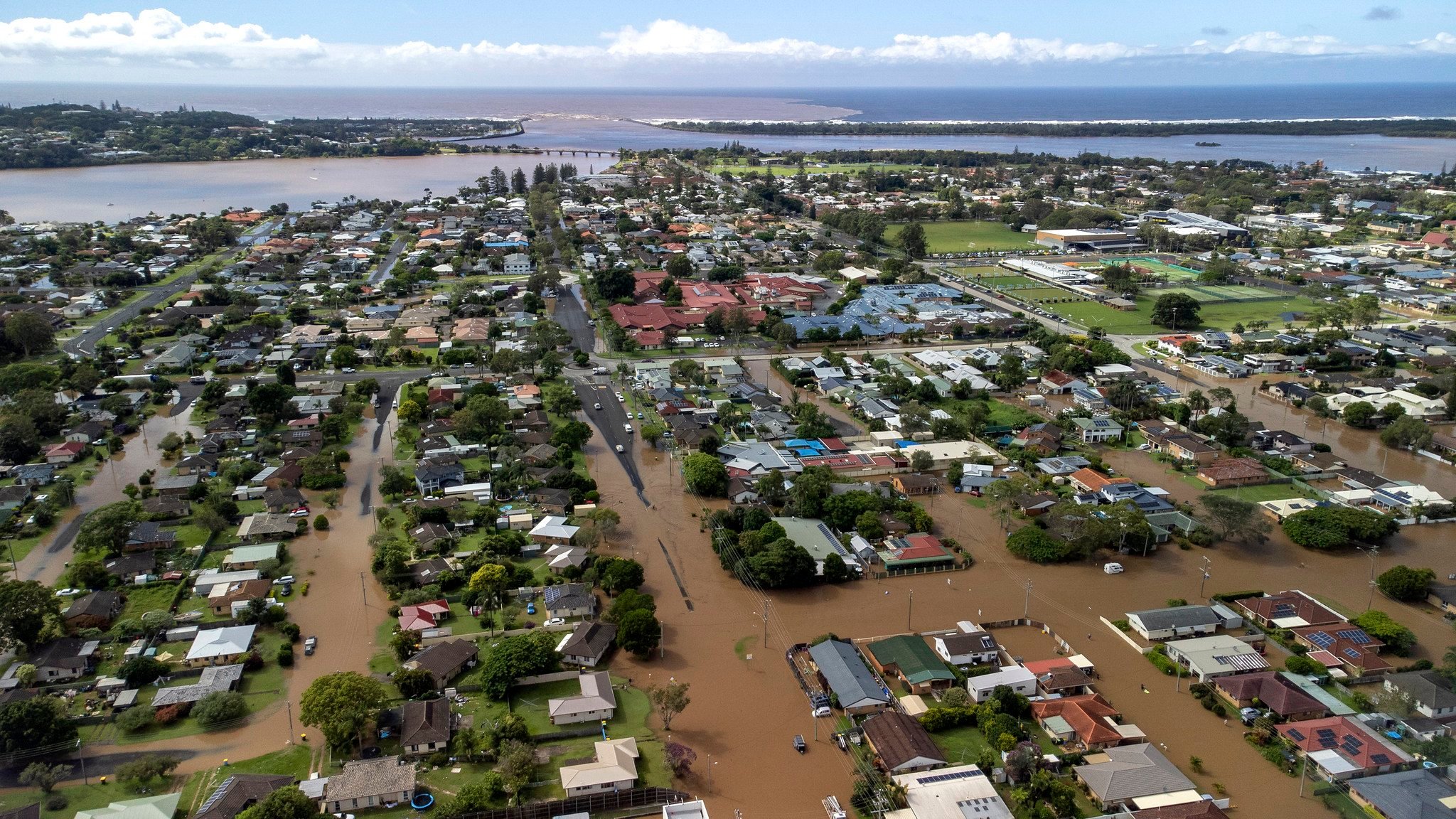
Flooding and damage to homes and businesses in New South Wales are as big an issue as they are in Queensland where I now live.
The recent local floods are the fault of the ongoing development practice by which buildings are permitted to be built on floodplains. The oft-cited measuring stick is the phrase: ‘1 in 100-year flood’ level clearance. This sounds exactly like the situation back where I used to live, in nearby Byron Shire.
Currently government in Australia uses the 1/100 AEP (Annual Exceedance Probability – AEP) event, or ‘1 in 100-year flood’, with an appropriate additional height for buildings this is designated as having an ‘acceptable’ risk for planning purposes, regardless of the potential consequences of a flood. Obviously, this is unsatisfactory as climate change marches ahead.
What do senior scientists think?
The Office of Queensland Chief Scientist’s website says (www.chiefscientist.qld.gov.au/publications/understanding-floods/chances-of-a-flood): ‘Currently, the one per cent AEP event is designated as having an ‘acceptable’ risk for planning purposes nearly everywhere in Australia. However, good planning needs to consider more than just the one per cent AEP flood.’
The report added ‘one per cent annual exceedance probability (or one per cent AEP), are preferred because they avoid the common misconception that a “1 in 100-year flood” for example, can only occur once every 100 years; or that you are “safe” for another 100 years after you experience such an event. For example, in Kempsey, NSW, major floods approaching the one per cent AEP level occurred in 1949 and then again a year later in 1950.’
A recent example is the sorry experience of someone who in July last year, bought and upgraded a small regional store near Gympie. Only six months later they were devastated when the flooding rose up to halfway up the two-storey building. And it happened again in the recent floods! The owner had been assured that the site was robust as per ‘1/100 AEP’.
The same flooding happened on a nearby greenfield land, which has a DA already approved by Gympie Council. When asked, the developer quickly said, ‘Development Application had met the “1/100 years” rule. So the development can go ahead.’
Mathematically calculated by hydrological engineers
On checking on this flooding issue with Gympie’s Regional Council, their Director of Community Sustainability, Adrian Burns, explained, ‘A 1/100 flood event is an event that is mathematically calculated by hydrological engineers… [The] development must meet the requirements that were assigned at the time of the assessment [in this case, back in 2013 when the DA was originally approved]. Please note that the buying and selling of land has no council involvement. Additional requirements cannot be placed on an already approved development applications in the future, should certain benchmarks, such as flooding, change.’
In other words, for existing developers with an approved DA, ‘no worries’. But buyers, beware! The recent approval of mega-development of the ‘locals’ West Byron DA is based on the same gob-smacking legal logic.
 For four decades The Echo has printed the stories some people loved, some people hated, and some pretended not to read. If you want us to keep telling the truth, the real truth, not the sugar-coated version. We’ll need your support to keep the presses rolling.