
The contentious Tweed Valley, Nightcap Village multiple occupancy (MO) $39M development application (DA) near Uki, promoted by Pete Evans, was refused by the Northern Regional Planning Panel (NRPP) in August 2021. They had one year to appeal the decision, and with one day to spare the MO solicitors lodged an appeal to the Land & Environment Court (L&EC) against the NRPP’s decision not to give approval for the project.
An ‘on site Mediation Conference’ was originally set for ‘9 and 10 February 2023’, however, this has now been moved to an online meeting starting 9 February.
The DA ‘seeks consent for a concept proposal comprising a staged rural land sharing community and associated works over 24 lots and Stage 1 civil infrastructure works’.
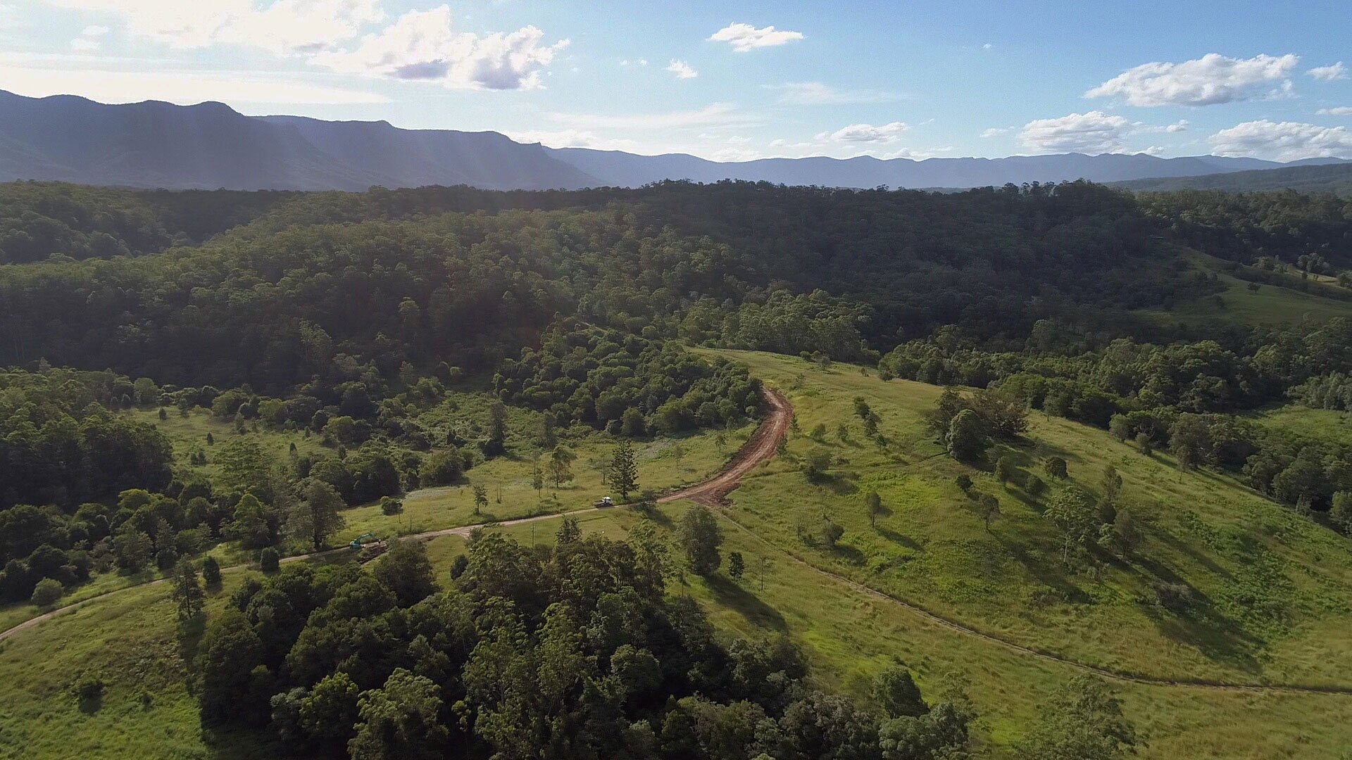
The proposal is for the development of 392 dwellings on 3,000 acres of rural land near Uki, stretching between Mt Burrell and Kunghur. Under the DA the land will be subdivided into ten Rural Land Sharing Communities (RLSC), alternatively known as MOs, and one village parcel. They estimate that approximately 750 to 1,500 people would reside in the proposed 392 dwellings of the ten proposed RLSC communities. The eleventh parcel of land, or village, would house between another 750 to 1,200 people according to the Northern Rivers Guardians who analysed the DA.

Dwarf Uki
The fact that the development will ultimately be larger than the nearby town of Uki of 800 people has also raised a range of concerns for locals. One key issue is the impact of significantly increased traffic in the area that will degrade local roads and cause congestion.
‘This DA adds another 1,000 + people, another 800 or more cars to Kyogle Road,’ said a concerned neighbour.
‘There are three bridges and significant work on the local [public] roads that would need to be done to make them adequate for the increased traffic of this DA.’
There is also a network of 26.5km of internal roads that would need further work for the development to go ahead.

Sewage and water
Locals have previously highlighted, at public meetings, that the DA proposes each house manage its own sewage and wastewater treatment as well as potable (drinkable) water supplies.
‘We note that Uki has its own wastewater treatment plant, operated by TSC, that services approximately 800 people,’ say NRG. They highlight that the impact of managing sewage and potable water for several thousand people once the ten RLSCs and the Village are in full operation saying that the infrastructure for this number of people should be considered a major infrastructure issue and not left up to individual households.
While the DA says that water will be mainly harvested as rainwater off roofs, NRG also notes ‘the opportunity for bores and springs also identified as available to the site’, raising concerns over the potential long-term impacts on the area’s water supply and management.

Deforestation
Objectors to the DA, at the 2021 March public meeting in Uki, said that among the numerous issues with the proposal the DA is seeking to ‘relocate’ and reduce to a quarter of its size a critical wildlife corridor.
‘The DA claims that no koalas inhabit the area and that no other endangered or threatened species are present on the site. [However], the major wildlife corridor that runs through the site connects Mebbin National Park with Nightcap National Park, and 48 threatened fauna species have been recorded, as the DA acknowledges (Appendix E2, page 38),’ say the NRG in their assessment of the DA.
Dr Sam Coulson, Caldera Environment Centre coordinator, told a public meeting on the DA in March 2021 that ‘the majority of the property is natural bush’ and that the proposal to ‘relocate’ the wildlife corridor, would reduce it to a quarter of its size, had ‘not been explained or properly researched’.
‘The risk to native fauna and the reduction of habitat and the impact on a healthy koala community is unacceptable. There are approximately 40 vulnerable species in the land proposed for development.’

Reasons for refusal
The DA was refused first by Tweed Shire Council on ten grounds and then by the NRPP with the following reasons for refusal:
- The concept is a prohibited sub-division
- It would cause undue harm to the environment
- It is in breach of the cap on population density
- The development would seriously affect a natural wildlife corridor
- There had been no Aboriginal Cultural Heritage survey
- The development would mean the removal of large areas of native vegetation
- The DA did not provide sufficient information to enable a determination of the suitability of the concept.
- The development was not considered to be in the public interest
- The development is in a bushfire-prone area and was not supported by the NSW Rural Fire Service.
Offsets $27m
The report to Tweed Council on which they originally refused the DA stated that:
‘The Development Application was referred externally to: Natural Resources Access Regulator, Heritage, Community Engagement – Department of Premier and Cabinet, NSW Rural Fire Service, Department of Planning Industry & Environment – Biodiversity and Conservation Division. All of the agencies either required further information or did not support the proposal. The Biodiversity and Conservation Division advised that they estimate the proposed development would require extensive land clearing of approximately 106ha of native vegetation with a further 220ha of impact in native populations and areas described as “cleared/grassed paddocks with scattered trees, regrowth and weed thickets”. The cost of Biodiversity Offsets required to offset the loss of biodiversity values to enable the proposed development is estimated in excess of $27 million.’

Last gasp
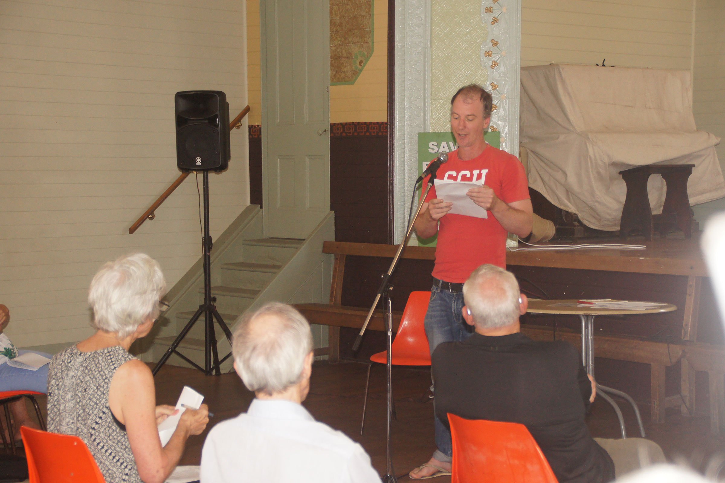
President of NRG, Scott Sledge, told The Echo that he thinks this is ‘a last gasp effort to see if there are legal grounds for turning around the DA’.
‘To achieve the final outcome proposed by the developers there are a significant series of steps that they would be required to go through from combining the various lots, then subdividing into ten MOs and the eleventh village lot. This is a DA for ‘Stage 1 civil infrastructure works,’ he said.
The first DA submitted was rejected by Tweed Council as they sought owners’ consent from the Tweed Council in relation to the use of public roads to access the property. This, the second DA, has taken out the request for owners’ consent and the work needed on public roads to support the DA.
‘Each step along the way would require another DA and at each of those points there would be a risk of the entire enterprise falling over,’ explained Mr Sledge.
MO structure does not let you buy land
The structure of a MO means that people investing in the development will not be buying a parcel of land. Instead, they buy shares or invest in a company or legal structure that owns the land. This will then provide them with certain entitlements – for example an area to build a house. However, they cannot take out a loan against the land they build on because they do not own it. To take out a loan the entire property would have to be put up as collateral.
Denise Nessel, Secretary of the Northern Rivers Guardians (NRG), who have been helping locals understand the implications of the DA, told the public meeting in March 2021 that if the property was only seen as one RLSC then they would be allowed a maximum of 80 dwellings on the property.
‘Dividing it into ten RLSCs to facilitate 392 dwellings [and then a village] does seem more like a typical urban development than an RLSC. An RLSC is usually set up by people who know one another and come together to create an intentional community,’ she told the meeting.
Ms Nessel pointed out that the DA doesn’t clarify the boundaries of the ten RLSCs and village, that the RLSCs do not get set up until stage 3 of the development so ‘who knows when you will have access to a plot of land to build on’. She also highlighted that it is difficult to work out from the DA what the company is that you are investing in and who owns the land.
No more MOs
At the beginning of March 2021 Tweed Shire Council (TSC) sought to put the final nail in the coffin on RLSCs in Tweed Shire by passing a motion ‘to remove Tweed Shire from the [state planning] SEPP’ that allowed RLSCs to be created in Tweed Shire. Multiple occupancies (or RLSCs) had already been removed from the Tweed Local Environmental Plan (LEP) 2000, and the Tweed Local Environmental Plan (LEP) 2014. However, as this DA has already been submitted it may be judged under the existing SEPP.
 For four decades The Echo has printed the stories some people loved, some people hated, and some pretended not to read. If you want us to keep telling the truth, the real truth, not the sugar-coated version. We’ll need your support to keep the presses rolling.