
Mullumbimby Residents Association (MRA) and Mullumbimby’s Community Resilience Group, ‘Our Neighbourhood’, congratulated Byron Shire Council for this week releasing much-needed 2022 flood data.
They say that following months of community advocacy, the new survey layer gives residents direct access to property-level data collected after the devastating 2022 floods.
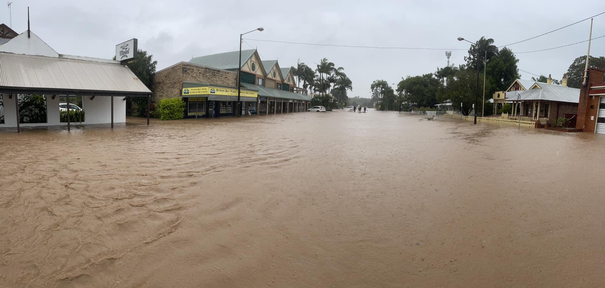
The home of Bec Talbot, from Our Neighbourhood, was flooded in 2022.
She told The Echo, ‘Residents can now visit Council’s online mapping tool to see exactly how high floodwaters rose at surveyed properties across the Shire in 2022’.
Decision-making tool
‘This is a real-life decision-making tool.
‘Flood-affected Mullumbimby residents have consistently raised the need for access to flood data. Mullumbimby’s Community Resilience Group met with Council staff to stress that families deciding whether to go into more debt to raise their homes deserve every available fact.
‘After 2022, many homeowners were left rebuilding and weighing up their future risk.
‘With the new map layer, people can see past flood marks on their own streets and weigh the cost and benefit of raising homes.
‘Raising homes helps avoid damage, but can create accessibility challenges, especially for older residents. Council’s newly-released data supports conversations about weighing risks with lifestyle choices such as remaining in your community.
‘This is about lives, homes and community resilience.
‘One-in-500 floods no longer feel “out of my lifetime”. With sea-level rises and intensified storms on the way, maps like this on Council’s website help people like me to decide their level of risk tolerance.’
How it works
While the newly released data is a welcome tool, the way in which it is presented is not easy to navigate for the layperson.
Go to www.byron.nsw.gov.au, then search ‘Online Map’. The ‘Online Map & Zoning Tools’ page will appear. Then click the ‘Byron Shire Council web map’ link.
From here, the Byron Shire map appears. Click on ‘Layers’ in the left column. In that list will be ‘flood information’.
Expand the ‘flood information’ link which will show more options.
Click on ‘Flood Height Surveys 2022 Public Works NSW’.
This can be compared to another link, ‘Flood Level Survey 2016 2019’.
Individual properties can be selected, and while not every property has a flood level, it can be compared to neighbouring properties that are marked with flood level.
 For four decades The Echo has printed the stories some people loved, some people hated, and some pretended not to read. If you want us to keep telling the truth, the real truth, not the sugar-coated version. We’ll need your support to keep the presses rolling.