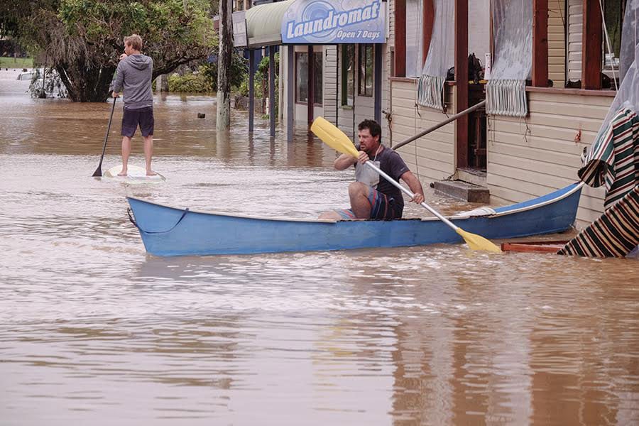
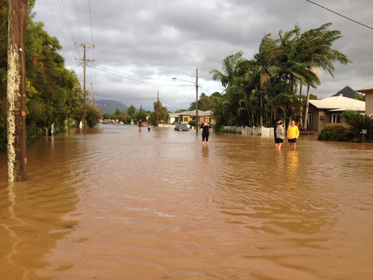
Cyclone Debbie devastated much of north Byron Shire in March/ April 2017, and was possibly the biggest flood ever recorded for the area.
So where are Council at when it comes to preparing for the next flood?
Aside from steps now underway as a result of the Byron Shire Floodplain Risk Management Committee (see end of story), it’s clear that there are blocked drains and culverts around Mullum’s east residential area, from Prince Street and the main road, Argyle Street.
That area, along with other areas such as Billinudgel, parts of Ocean Shores, South Golden Beach and New Brighton are obvious hot spots for future flooding events in the north of the Shire.
Regarding council’s blocked drains and culverts, former councillor and hydrologist Duncan Dey told The Echo, ‘It’s true that many gutters are blocked, uncared for and ignored. However, a gutter only carries water away when the water level “above” the blockage is higher than “below” it. If the river is up, the water can’t run away. Once the river has dropped, the gutters may block the exit of the water but those blockages may not have caused the flooding.
A smart system would clear the gutters – not because that would change the outcome in a river flood of the magnitude of cyclone Debbie – but it is worth doing for about a hundred other reasons. A huge one is to avoid water pooling in the drains and going stagnant. Another one is to reinforce to people that drains are for dumping stuff.’
And the quality of the drains may also play a part.
Council’s flood and drainage engineer James Flockton told The Echo that unfortunately Council’s drainage pipes – and generally all drainage managed and built by NSW councils – are only designed to withstand five- and ten-year rainfall events, at best.
He said, ‘Constructing infrastructure to withstand 100 year flood events is very expensive. Inadequate drainage can be seen especially in older subdivisions, where the overland water-flow paths were not properly catered for.’
As for budgetary constraints, staff advised, ‘There is an additional allocation for drains maintenance in the 2018/19 financial year from the money Council receives from the special rate variation. Council acknowledges that there needs to be an increase in the budget for the maintenance of drains. In response to ex-tropical Cyclone Debbie, Council has allocated increased funding of approximately $37,000 for urban stormwater in the north of the Shire.’
Mullum flooding
Regarding the flooding issues around Mullumbimby, Flockton told The Echo that Saltwater Creek, located to the south east of the town, is seen as a potential mitigation flow path. ‘It passes three culverts (drains), which are constrained.’
‘If improved, it could allow flows to bypass the town and the creek could be diverted into Kings Creek (further east of the town towards McAuleys Lane). We are also looking into floodgates as a mitigation measure near Argyle Street, located on land to the left before the residential area when approaching town.’
South Golden Beach
As for issues in South Golden Beach (SGB), Flockton said there was no way to fully address future flooding in that area without the use of a pump. ‘The influence of ocean levels on flood levels is too great,’ he said.
‘A levee of any type will always need a pump,’ he said. ‘Any houses built inside the SGB levee rely upon the existing pump; however, Council still require habitable rooms to be above the flood planning level.’
Flockton made the point that some houses in the SGB flood prone areas may have habitable rooms on the lower floor which may be below the flood planning level.
Former councillor Dey agreed a pump will always be needed for the beach areas of New Brighton and SGB, as the lands ‘cannot be drained in big floods like Debbie, because the yards are subdivided and now support houses that are below the flood level (or close to it).’
He said, ‘In addition, there is a levee around parts of SGB and a gigantic flood lifter pump to extract local stormwater from the suburb inside the levee when Marshalls Creek is elevated and gravity flow fails. This is a shocking piece of bad planning that will require such pumps for ever. I understand in 2017 the pump failed, as it has in most floods since it was installed.’
Yet SGB residents and Council have been proactive in re-establishing street drainage in the area.
Flockton said, ‘Peter, Robin and Helen Streets (South) have been done so far and it’s an ongoing program.’
As for implementing the recommendations of the Floodplain Risk Management Committee, he says building a levee, or a structure to protect against flooding, at Billinudgel could be relatively easy if modelling supports this idea.
‘It would be harder to do a similar thing around Mullum, owing to the length of creek that runs around the town. So a levee for Mullum has been deferred for now.’
‘This will be the first of two phases,’ he said.
Other options being assessed to improve flood flow includes dredging of Marshall’s Creek from Billinudgel to the mouth of the river, as well as parts of Brunswick Heads and Mullumbimby. Ocean outlets and changes to the rock walls are also being considered.
However, Flockton conceded that dredging was not considered ideal or entirely effective.
‘There are two changes being modelled for walls near the marina in Brunswick Heads,’ he said. ‘One wall is just below the surface of the water, yet it’s unclear whether these changes will improve flood flow as they are below the water’s surface.’
Former councillor Dey added, ‘Drains are easily blocked on flat terrain but difficult to block on slopes such as in Mullum’s Tallowood Estate or parts of Ocean Shores. One common form of blockage is the convenient disposal of lawn clippings and garden cuttings, under the notion that the next storm will carry them away. Rocks, gnomes, etc can block drains nicely too. The home landscaper might also fill a drain to get the family wagon across it, or simply bog the car in it and deform the wet soil to block flow. Many people don’t recognise the key function of a drain, which is to transmit water.’
Council’s flood mitigation plans
- As a result of the Byron Shire Floodplain Risk Management Committee meeting, held on June 14, staff have been asked to investigate ‘Dredging of key areas of the [Marshalls] creek system’, as well as ‘Changes to key parts of the rocks wall at Brunswick Heads (two options)’.
- A flood outlet through the dunes north of South Golden Beach, and another between New Brighton and South Golden Beach will also be investigated by staff, along with a ‘combination of the two flood outlets.’
- ‘Channel enhancement’ around Mullumbimby would be looked at, as well as a flood levee, or embankment for Billinudgel.
- Additionally, changes to the North Byron flood model have been approved, which includes estimating how the Brunswick River responds to flooding, as well as updates to culverts and drainage around the Shire that were previously not included in the original modelling.
Other changes recommended by Council’s consultant were also adopted.
 For four decades The Echo has printed the stories some people loved, some people hated, and some pretended not to read. If you want us to keep telling the truth, the real truth, not the sugar-coated version. We’ll need your support to keep the presses rolling.