 A 38 large-lot development applications (DA) near the busy Mullumbimby Road/ Uncle Toms intersection has quietly been re-advertised on Council’s website, with senior planning staff confirming at last week’s Council meeting it was initially incorrect.
The proposal will have considerable impact on access into, and out of, Mullumbimby if approved, given there are already around 13,000 vehicle movements per day.
The latest public exhibition started on April 9 and ends on May 9 for the Community Title (CT), and the plans have again attracted strong criticism from neighbours, who engaged consultants to peer review the DA.
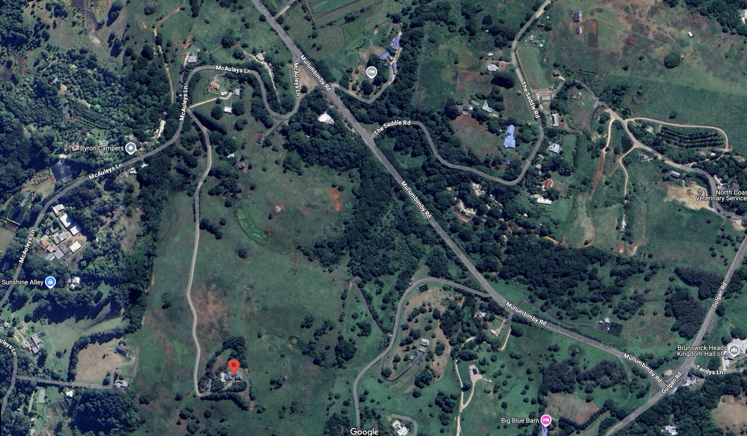
As previously reported, DA 10.2023.454.1 at 53 Mcauleys Lane came with a myriad of unanswered questions and issues, including traffic, where the applicant was relying on out-of-date data.
It was also referred to the Northern Regional Planning Panel (NRPP) to determine.
The proponents are wealthy local developers John Callahan and Tim Mundy, and their DA comes in 41 separate parts, containing hundreds of pages. The estimated cost for the 34.82ha subdivision/infrastructure works is $2,867,339 ex GST.
Cr Jack Dods was the lead design coordinator for the project at the time, and neighbour contact for the DA, yet neighbours say they were never consulted. Cr Dods has since distanced himself from the project, and has also recused himself from traffic planning committee meetings around planned works for the Mcauleys Lane and Mullumbimby Road intersection.
Issues as raised by neighbours
In summary, neighbours say the ‘slightly changed’ Traffic Impact Assessment (TIA) within the latest DA is still unsatisfactory, despite requests for more information (RFIs) from Council.
‘There is no incorporation of increased numbers expected for The Saddle Road,’ they said.
‘The current proposed roadworks on the intersection favour the developers. It does not incorporate the approved Mullum Bruns cycleway.
‘The promised second eastern bus stop, pedestrian and cycleways to the proposed site, are removed from DA plans and volunteer planing agreement (VPA).
‘There is no Aboriginal Cultural Heritage Assessment report, and questions remain unanswered around the Biodiversity Assessment. Many proposed lots also encroach in NSW Department of Planning and Environment (DPE) environmentally sensitive areas’.
The issue of why the DA was again before the public was brought up at the end of last Thursday’s meeting by Greens mayor Sarah Ndiaye.
She tabled a status report on ‘DAs with bodies like the Northern Regional Planning Panel (NRPP)’.
Senior planner, Chris Larkin, said there were two reasons it needed to go back before the public for comment. He said, ‘It came to our attention, by one of the neighbours, that we advertised it incorrectly, because originally we thought Council was the consent authority’.
‘About six months into the assessment process, it turned out that the NRPP were the consent authority.
‘And when it was pointed out to us around a month ago it had been advertised incorrectly – to make sure this application proceeded without the potential for a third-party challenge – we’ve had to re-advertise again.’
Intersection upgrade
Larkin said secondly, there was an ‘amended planning agreement to do with the intersection upgrade’.
‘That’s all on exhibition, which we are required to do’.
When pressed by the mayor as to why it was referred to the NRPP, Larkin said there is a ‘little sliver of land which is on the coastal zone, and, not that there are any lots down in that area, but my understanding is that then brought the NRPP into play’.
The Echo understands that rural-residential subdivisions with more than 25 lots trigger NRPP intervention as ‘regionally significant development’, and that staff also failed to refer the DA to the NRPP on those grounds.
 For four decades The Echo has printed the stories some people loved, some people hated, and some pretended not to read. If you want us to keep telling the truth, the real truth, not the sugar-coated version. We’ll need your support to keep the presses rolling.