Mary Gardner
On May 12 (low tide 11.36 am), take a few minutes and help track down the elusive mysterious highly prized wild shellfish reefs and beds somewhere near you. Whether you are on the coast from the Brunswick to the Richmond, or along any waterway large or small going inland, use the free phone app to photograph any oysters, mussels, pipi, clams and burrowing clams you find. It’s our region’s First Wild Shellfish BioBlitz.
This Shellfish BioBlitz is an aquatic variation of the 24-hour wildlife censuses all done by volunteers. The first census was 1996 in the United States. Now, BioBlitzes are popular all around the world because citizens and specialists are equally thrilled with the discoveries made.
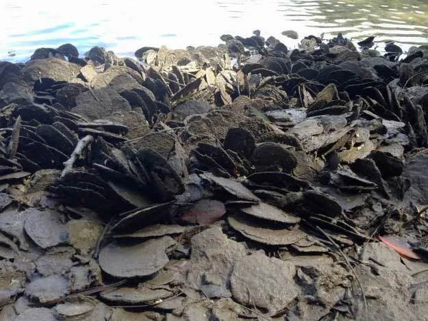
In this region, the Wild Shellfish BioBlitz might solve some longstanding critical mysteries. The first is the Curious Case of the Last Refuges. Once the coast and waterways of this region held millions of wild shellfish: three species of oysters, six species of freshwater mussels and one marine, at least several freshwater clam species plus five marine. Since the 1800s, these shellfish experienced large prolonged harvests, drastically changed conditions on land and in the water as well as pollution of every sort. Today, where are the survivors? There must be at least a few somewhere.
Another is the Mystery of the Missing Oyster Species. So many stories float around this region about the flat oyster also known as the mud oyster Ostrea angasi. These are similar to the highly prized European Ostrea edulis now also grown in the United States. There is only single known wild flat oyster reef in Tasmania. The species is of special interest to the global gourmet market. Is there any truth to the anecdotes about flat oysters in our region?
What about The Adventure of the Leaf Oysters? They were seen attached to mangrove trees, aerial roots and spreading across the muddy surfaces. That’s how these Isognomos ephippium are also called tree oysters. Where are they?
Of great cultural and historical significance is The Adventure of the Burrowing Clams. These Teredinidae should be found in submerged deadwood in coastal wetlands and intermittenly closed and open lakes and lagoons (ICOLLs). Aboriginal people of the east coast cultivated their favourite species. They carried the long thin animals from one place to the next, inoculating submerged logs of dead Causarina (she-oaks).
As a courtesy, Aboriginal people in this region offered burrowing clams as delicacies to visitors. They sent them as gifts to as far south as the land of Eora (now Sydney). British colonialists disparaged them as ‘mangrove worms’ and refused to eat them. But other settlers around the world prize them as ‘long oysters’. So where are any burrowing clams?
The Problem of the Pipi is one repeated all along the east Australian coast since the 1800s. For millennia, Aboriginal people prized these surf clams Donax deltoides as food. They collected the shells in middens metres high and kilometres long, using these as caches for tools and special items as well as burial sites.
Here from 1880s to 1970s, pipi endured the tailings of gold mining and the brute force of sand mining. They were crushed by vehicles driven across beaches. Rock walls eroded the soft sands they needed. Finally, they were subjected to heavy harvesting, an activity without quotas until 2007. In 2018, where are any pipi?
The last mystery About The Rare Word is one a little outside of our region. The Aboriginal word Yamba means abalone. Does anyone know of the whereabouts or anecdotes about this prized shellfish from around the Clarence or anywhere further north?
So these are just six mysteries of the aquatic world around us. Collect your family and friends and join the BioBlitz. Together, we might find a few more clues.
♦ Sign up for Wild Shellfish BioBlitz by emailing: [email protected] for links to download the FAIMS app.
 For four decades The Echo has printed the stories some people loved, some people hated, and some pretended not to read. If you want us to keep telling the truth, the real truth, not the sugar-coated version. We’ll need your support to keep the presses rolling.