


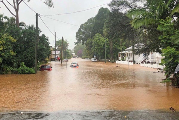
A new flood study commissioned by Byron Shire Council has identified five key flood flashpoints in Bangalow, including the current location of the local fire station.
In a development with significant implications for emergency management, community safety, and future building in the town, Council has received the final Bangalow Flood Study after years of preparation and analysis.
The study was formally endorsed by Council’s Floodplain Risk Management Advisory Committee on February 26, and will now go out to public exhibition for 28 days.
The study is a key document containing an assessment of flood behaviour in the township, evaluating both riverine flooding and overland flooding from urban stormwater systems.
It includes modelling calibrated to the extreme February-March 2022 floods.
Byron Creek
It found that riverine flooding from Byron Creek and its tributaries was the dominant flood risk to Bangalow.
Five key riverine flood flashpoints were identified across the township, including the East Industrial Area and Lismore Road, Deacon Street and Ashton Street, George Street and Market Street, and the Raftons Road crossing of Paddys Creek.
‘Several of these locations experience deep and fast-moving floodwaters that affect multiple properties, critical road connections, and emergency access routes,’ said the authors of the study, Wilde Engineering Consulting.
Fire station access
‘Of particular note, flood modelling indicates that access to the Bangalow Fire Station via Deacon Street is impacted during relatively frequent flood events, while alternative access routes are also compromised under larger and future climate scenarios.
These combined constraints represented ‘a material consideration for emergency response capability and evacuation planning,’ according to the report.
‘When considered in conjunction with the modelled inundation of Lismore Road and impacts on connectivity to regional emergency services, including Lismore Base Hospital, these combined access constraints represent a material consideration for emergency management planning and response capability assessment.’
In addition to riverine flooding, the study identified five localised overland flooding flashpoints where intense rainfall exceeds the capacity of the urban stormwater system.
These areas were primarily characterised by temporary street ponding and localised flow paths that could disrupt traffic and pedestrian movement.
While overland flooding is generally less severe than riverine flooding, these locations still presented safety risks and ongoing operational and asset management challenges the study found.
The study’s modelling indicated that riverine flood levels were projected to increase significantly as a result of climate change, with increases of approximately 250 to 500 millimetres at major flood flashpoints by the late century.
‘These increases result in a greater number of properties experiencing above-floor flooding, more frequent and longer road closures, and heightened flood hazards to people and infrastructure,’ the study’s authors stated.
‘Overall, the findings confirm that flood risk in Bangalow will intensify over time, even in the absence of additional development.’
Future development
The study has significant implications for future development in the town, as Council is required to take it into consideration when making future planning and development decisions.
It establishes preliminary Flood Planning Levels (FPLs) for Bangalow to guide future planning and development decisions.
 For four decades The Echo has printed the stories some people loved, some people hated, and some pretended not to read. If you want us to keep telling the truth, the real truth, not the sugar-coated version. We’ll need your support to keep the presses rolling.