
As the residents of Burns Point Ferry Road clean up from flood water which has inundated their homes, they say the next flood could be even worse if a massive development is approved nearby.
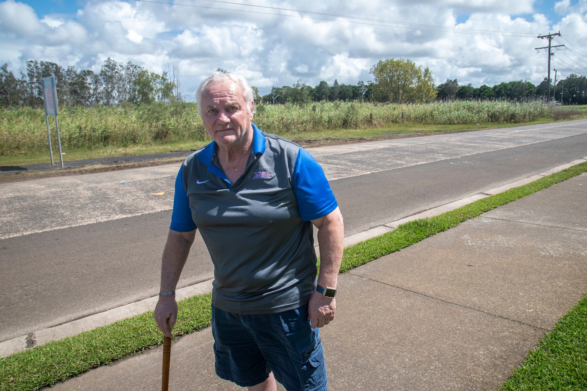
John Chaseling and his Marilyn had to evacuate as 900 mm of water came into their house. It took three days before it went back down. They have removed the gyprock in their walls and begun the long process of recovery. ‘We’re a bit shellshocked at the moment,’ said Marilyn Chaseling.
Neighbour Anne Lodington lives a few doors down. She was away visiting relatives when the flood hit. Her daughter had to evacuate her husband (who has advanced dementia) on a kayak.
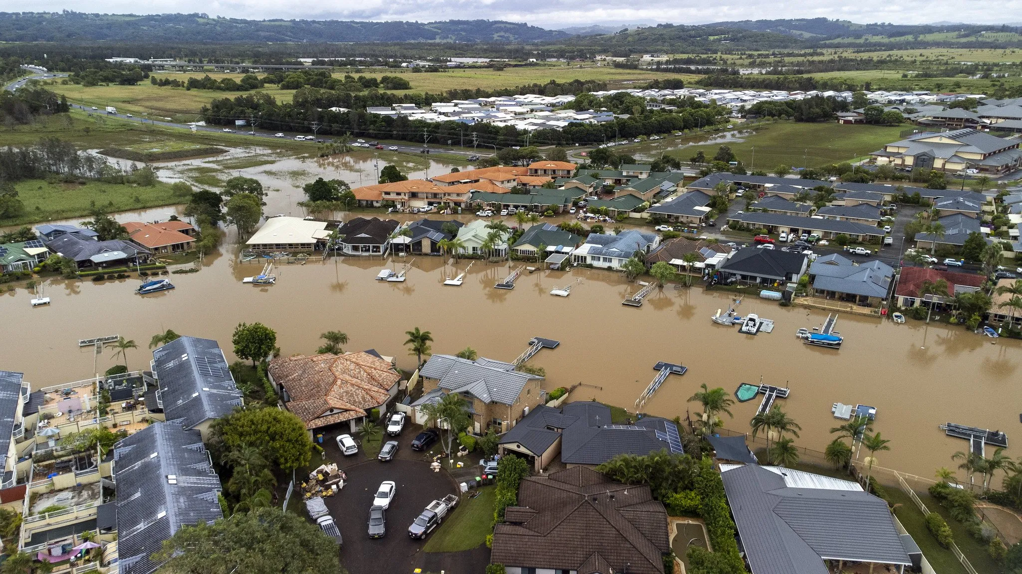
After 18 years in the area, the worst previous flood made it to their driveways and stopped. 2022 was a very different story.
Development proposal
For some time the people of Burns Point Ferry Road have been fighting the GemLife DA on the low-lying land opposite, which would bring hundreds more houses into an area which has recently seen severe flooding.
Locals fear the project would make future floods much worse.
Local planning consultancy Planners North have described the GemLife development as a ‘resort-style retirement village, boasting a revolutionary concept for over 50s living, with a primary focus on health, well-being and social interactions.’
Mr Chaseling lives directly opposite. He told The Echo the most recent version of the DA had been thrown out by the NSW Land and Environment Court over multiple concerns, but the developers were still trying to proceed.
‘Our concern is that if they build this property up over here, two meters [high] is what they’re talking about. That’s 155,000 truck and dog loads of fill to come in. That’s supposed to come off the highway, but you can see what’s going to happen.
‘Then we would be faced with up to 300 houses in there, traffic going in and out all day every day, right on our driveway… and in the high tides and the king tide, they would be stacking up in water.’
Mr Chaseling believes that if the development had been in place at the time of the recent flood, ‘we might have been wiped out. We would have for up to two meters in the house.’
Marilyn Chaseling agrees. ‘If you suddenly fill up that whole area there and build it up, all the water has to go somewhere. That’s just common sense.’

Considering the recent flood was so high that rescuers were able to kayak over back fences, it’s an alarming thought.
Locals are concerned that despite the Land and Environment court ruling in November, surveyors working for the developer have been photographed surveying the neighbour’s side of the road as recently as a month ago.
Other workers have been found taking soil samples and doing water testing, with residents told in a phone call from Planners North that the project was proceeding.
Ballina Shire Council
John Chaseling says the onus is now back on Ballina Council. ‘If they accept another development application over here, they’re really in a criminal situation, because to do what they were talking about by raising the level is going to create so much havoc on the infrastructure here, the issues with the streets, the sewer problems and the drainage problems.
‘There’s no way for the water to go except around that piece of property,’ he said.
Mr Chaseling formerly worked for AV Jennings, and says many of the figures around the proposed development are ‘ludicrous’.

‘When GemLife originally put their application, they budgeted it at $29 million, which is under the $30 million limit. So it didn’t have to get through the state planning people. I alerted to the council that this was absolute nonsense.
‘When they repriced it, it came out at about $55 million.’
He said the whole thing really has been very poorly handled, not only by the council, but in particular by the developers. ‘They haven’t been truthful with anybody from day one.’
Neighbour Anne Lodington agrees. ‘They didn’t do their homework, as the Land and Environment Court pointed out over and over again. The experts didn’t do their homework.
‘I know infrastructure has to go in, like bridges and roads. But every time a man-made structure is built, it’s going to change the watercourse some way. This has been my concern from the very beginning.’
As an example, she says hydrologists working for insurance companies have been examining the effects of the new highway on record floods in Woodburn. She says the sanding up of North Creek has also been dramatic since the bridge was changed.
Richmond suffering
Mrs Lodington says the Richmond River is already one of the least sustainably managed waterways on the east coast of Australia, and inappropriate development is making a bad situation worse.
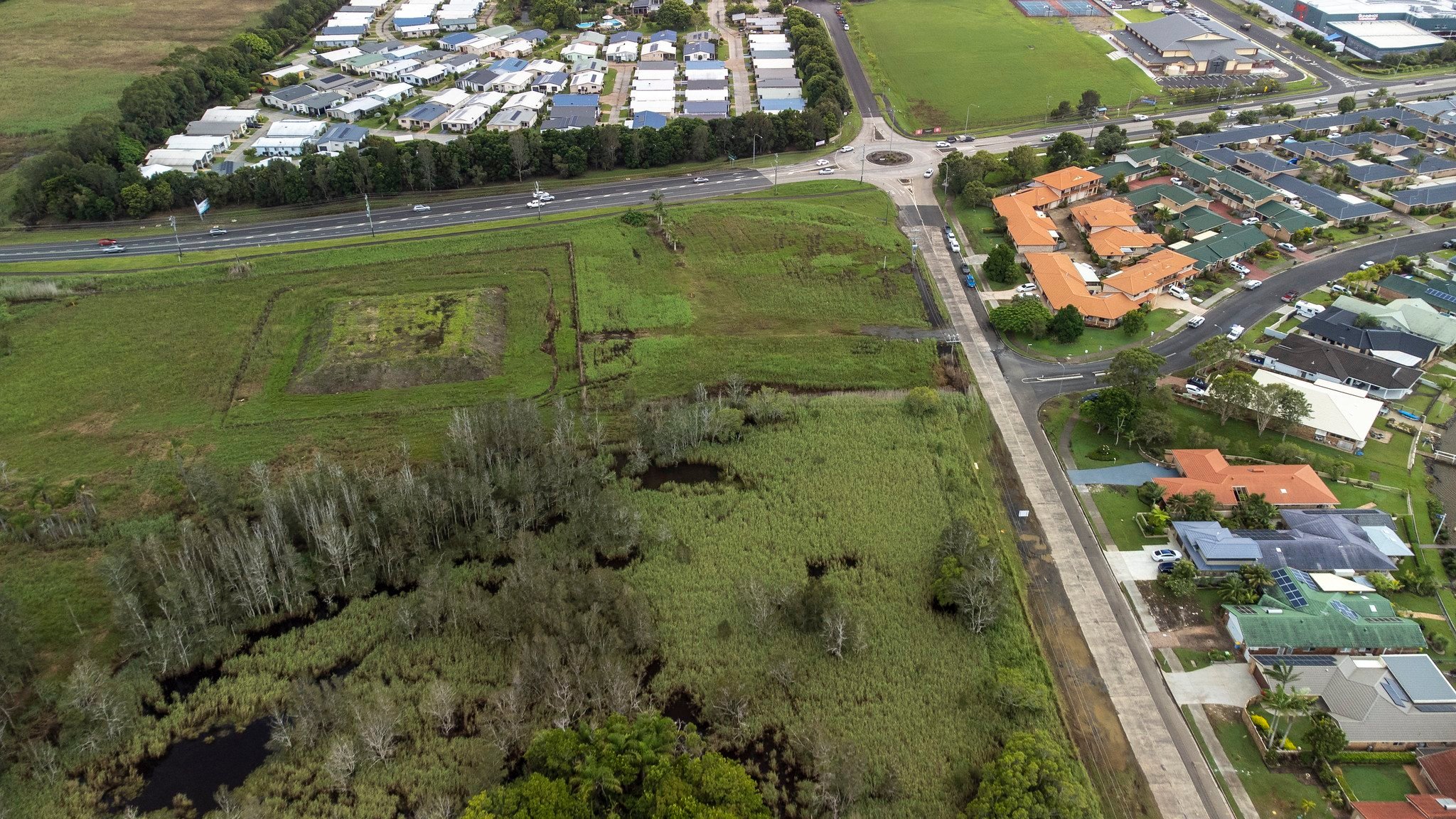
‘To do a development like that over here on swamp land and wetland… half of that land is environmentally zoned, and the rest of it is adjacent to environmentally zoned land, which should not be built on, and that’s what the Land and Environment Court has been pushing.’
She says council would be ‘irresponsible, or worse’ to allow development on the GemLife site.
Marilyn Chaseling says she was shocked to discover at the last community meeting that the proponent is proceeding after being soundly rejected by the Land & Environment Court. She also says the claims from GemLife that it’s an over-55 development are inaccurate, as the proposal does not include facilities that would be needed for such a development, even if it was reduced to 230 dwellings.
John Chaseling says the publicly stated proposal to move transportable housing on to the location is also not accurate, with the actual plan to build dwellings on site.
In terms of density, another resident of the street who is an engineer said he had visited a community built by the same developer at Woodend in Victoria which had spacing as tight as 200 mm between the eaves of adjoining properties.

From Marilyn Chaseling’s point of view, the biggest concern remains the water issue. ‘If you build on this land and put a block in the middle, the water’s got to rise.’
Anne Lodington says Burns Point Ferry Road was ranked 13th out of 14 on the list of Ballina Council’s priorities for flood concerns as recently as February.
It appears much risk management work needs to be revisited in the wake of the latest inundation.
As the housing crisis bites, and the climate crisis worsens, it seems clear that pressures on flood-prone land for housing are only going to grow, with sadly predictable risks for all concerned.
 For four decades The Echo has printed the stories some people loved, some people hated, and some pretended not to read. If you want us to keep telling the truth, the real truth, not the sugar-coated version. We’ll need your support to keep the presses rolling.