Wherever you look we have politicians saying there will be ‘no more development on floodplains’ yet the message just doesn’t seem to be getting through.
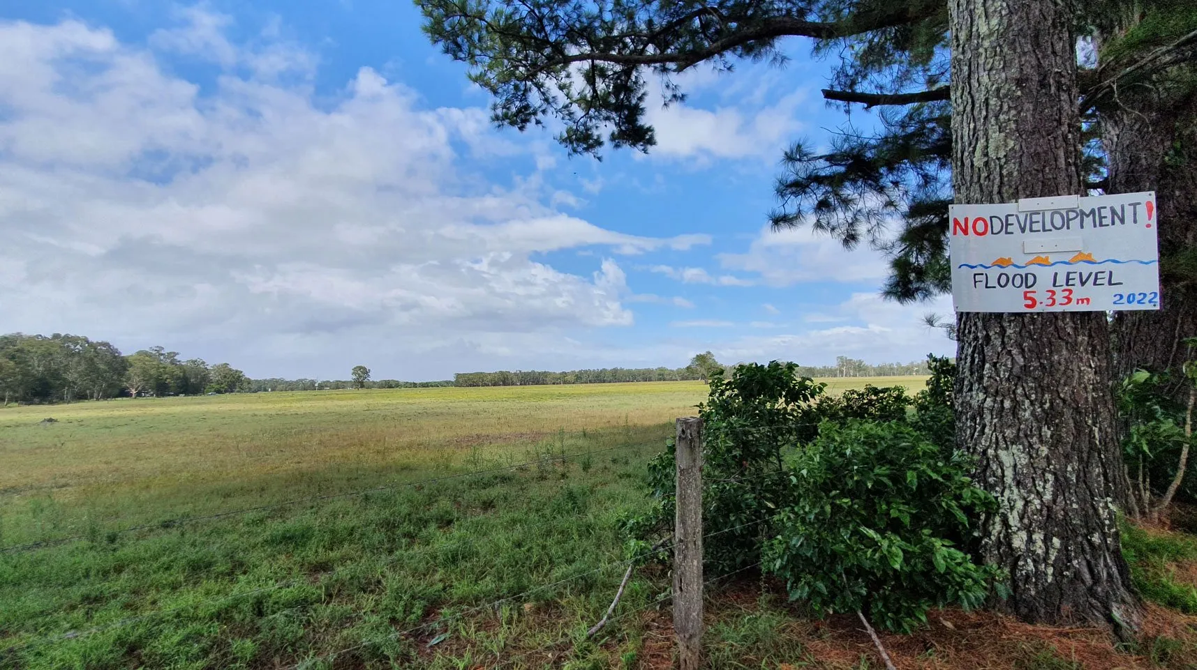
The Richmond Valley Council (RVC) has been asked to approve a 60 Lot Residential Subdivision on Rileys Hill Road, Broadwater on a floodplain 70 metres from the Richmond River. According to locals the area flooded extensively during the 2022 flood with many houses across the road from the site being flooded up to and including the first floor.
The proposed subdivision plan was prepared by Ardill Payne in December last year (2022), for client Broadwater Riley Pty Ltd. The Australian Proprietary Company was registered on 3 December 2020 and has its registered office in Lennox Head.

High flood depth
A Flood Plan prepared by Ardill Payne for Broadwater Riley Pty Ltd identifies the site as a ‘high flood depth hazard in the current Richmond Valley Council (RVC) flood maps’. Council’s definition of this hazard is ‘based on a 100 year design flood – area where floodwaters are deep but are not flowing with high velocity’.
Dr Richard Gates from Evans Head Residents for Sustainable Development said today that his group had received a number of calls from Broadwater Residents concerned about the proposed subdivision.
‘These were not NIMBY calls (not-in-my-backyard) but calls with genuine concern about future residents being put at risk. These were calls based on the “lived experience” of being in Broadwater during the 2022 floods when Broadwater sustained massive damage with the local school out of action, folks traumatized by what happened and many displaced as a result of the deluge.’

Flood mapping out of date
Dr Gates said today that the analysis provided by Ardill Payne was based on material from Richmond Valley Council’s 2021 Development Control Plan (DCP) which is now clearly out of date and should probably not be used for planning on floodplains so close to the Richmond River.
‘I must admit to being very surprised that the consultants are using old information pre-2022 floods to make an assessment of risk. Council’s Floodplain Risk Management Plans “adopt a flood planning approach which takes into consideration social and environmental considerations alongside economic benefits” and is based on Floodplain Risk Management Plans for the Mid-Richmond.
‘As far as we know up-to-date Floodplain Risk Management Plans for the Mid-Richmond are not yet available and may not be for a couple of years. It would seem very unwise to approve a subdivision in the absence of the necessary contemporary information to inform risk.’

Missing flood maps
Council’s Flood Planning information makes it clear that there must be ‘no compromising of the safety of residents and the community’.
Dr Gates said he wondered what contemporary information Council did have about flooding in the Mid-Richmond. We know for the Evans River Estuary which receives flood waters from the Richmond at Woodburn through the controversial Tuckombil Canal, once called the ‘Evans Head Drain Project’, that the flood waters were 1.7metres higher than they had been before in recorded history. They caused flooding in many parts of Evans Head including the controversial Iron Gates site.
Dr Gates said that not only were the 2014 plans available through Council wrong in terms of catchment information but two of the three plans including hydraulic and fine detail mapping were not held by Council raising serious questions about Council’s capacity to form judgments about flood risk.
‘How can you make an informed decision about flooding when the information is not only incorrect but missing?’

Inconsistencies
Dr Gates said he had written to Rous Council in 2014 about the inaccuracy of the flood maps and had received a polite note letting him know that someone would come back to him, but that didn’t happen. He said he had also written to Rous more than a month ago asking for the two maps but again had received nothing.
‘In view of the Evans River flood data problem you have to wonder about the Mid-Richmond Flood data for Broadwater. Certainly the residents of Broadwater we have spoken to share our concern and have the view that until up-to-date information is available there should be no consideration of the subdivision proposal.’
Dr Gates said it was interesting to see that the Broadwater proposal was not listed in the Richmond Valley Draft Growth Management Strategy nor did it appear as an ‘investigation area’ in the North Coast Regional Plan 2041 but it was shown in Council’s 2012 LEP as the ‘RU5 Village’.
Dr Gates said it would not surprise him if new flood data showed that the site was unsuitable for residential development particularly given the effects of predicted sea level rise on the river system which reached well up into Broadwater. The land should most probably be rezoned to non-residential status.
‘While we are waiting for up-to-date information it would seem appropriate for the proposal for subdivision to ‘“lie on the table” in keeping with the precautionary principle and intergeneration equity, principles which govern planning for local government and NSW. Why put people in harm’s way?’
 For four decades The Echo has printed the stories some people loved, some people hated, and some pretended not to read. If you want us to keep telling the truth, the real truth, not the sugar-coated version. We’ll need your support to keep the presses rolling.