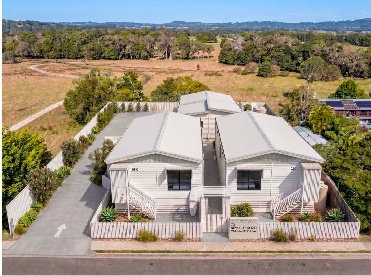
Six units are proposed at the eastern end of New City Road, Mullumbimby, on a site that was inundated during the 2022 floods.
Submitted by Duncan Band’s Kollective, Development Application (DA) 10.2026.269.1 at 73 New City Road is on public exhibition with Byron Shire Council, and sits within the Shire’s flood planning area.
The estimated cost is $1,855,794.00.
Flood assessment
The application’s flood assessment, prepared by Ingen Consulting, acknowledges that the site carries flood hazard ratings ranging from low H1 to very high H4 at the one-in-100-year flood event, with the highest hazard areas around the driveways and building surrounds.
More concerning is the Probable Maximum Flood (PMF) — the theoretical worst-case flood event — which engineers calculate could reach 1.5 metres above the minimum floor height of the proposed dwellings.
All heights in the report are measured in Australian Height Datum (AHD), the national standard where zero approximates mean sea level.
Additionally the consultant suggests flood safety guidelines are not adequate, as prescribed by the NSW Department of Planning, Housing and Infrastructure.
Shelter In Place guidelines
On page 32 of the Flood Assessment report they say that, ‘Shelter In Place (SIP) guidelines states that it considers SIP where flash flooding is the only flood risk present. Although the subject site does fit the criteria of flash flooding based on the quick response time to a storm… Flooding at the subject site has tidal influences and has a larger catchment and therefore has characteristics of long duration flooding’.
On page 34, the consultant says given the location, a ‘Shelter In Place is not a suitable flood emergency response strategy for this site’.
On page 35 of the Flood Assessment report, evacuation is listed as the primary safety strategy, with the Ex-Services Club on Dalley Street as one of the nominated destinations — a building that is itself flood-affected.
The entire site lies within a Fill Exclusion Zone, which under Byron Shire’s development controls is meant to prevent the displacement of flood storage.
Ingen Consulting argues on page 21 the development actually improves flood storage by removing the enclosed subfloor space of the existing dwelling — which, under Council’s DCP, counts as fill because it displaces floodwater — and regrading the land beneath the proposed buildings.
On page 6 of Ingen’s flood assessment it says that no flood modelling was conducted.
And on page 16, the flood report challenges Council’s sea level rise projections, citing 2025 research by Kamphorst, Voortman & O’Brien to argue that the adopted figures — 0.4 metres by 2050 and 0.9 metres by 2100 — may be overstated. Council is bound by its currently adopted assumptions unless it formally revises them.
Affordable housing?
On affordable housing, the application designates just one of the six dwellings as affordable. Within the 2 page Affordable Housing Management Plan, they say it would be at 80 per cent of market rent for 15 years from the occupation certificate. Management would be handled by North Rivers Housing or Link Wentworth Housing.
The remaining five dwellings carry no affordability conditions.
A separate, anonymous planning submission argues that since 73 New City Road lies more than 800 metres walking distance from the relevant prescribed zone boundary, the SEPP (Housing) 2021 planning pathway – which can override local controls – should not apply.
The DA is available at Byron Shire Council’s website or by viewing the document at Council’s offices.
 For four decades The Echo has printed the stories some people loved, some people hated, and some pretended not to read. If you want us to keep telling the truth, the real truth, not the sugar-coated version. We’ll need your support to keep the presses rolling.