Mary Gardner
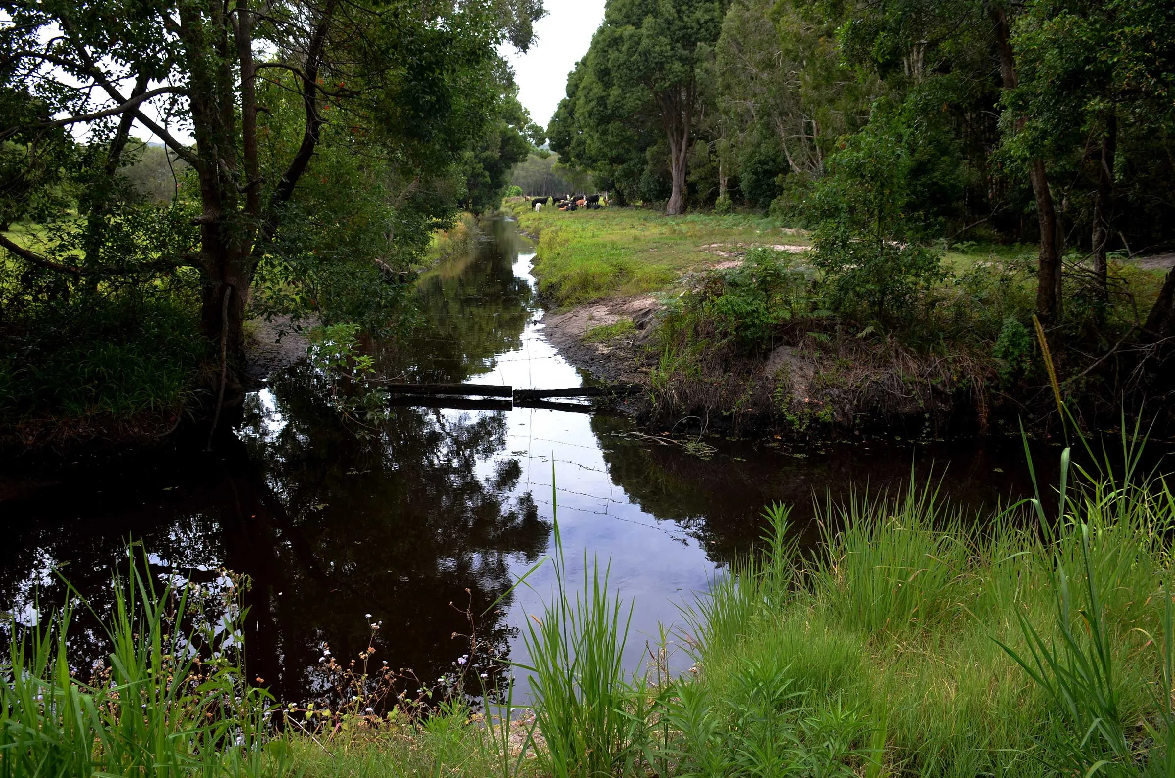
Staring into the water channels of West Byron, I’m searching for futures for marine and freshwater wildlife and their homes. For all of them, the coastal squeeze is a matter of life and death. Every heatwave, drought, flood, or storm increases the pressure. What to do?
Coastal squeeze is a pincer. Development in floodplains and on shores means walls, roads, residences, and every kind of construction are built. These form hard barriers at or just beyond the current high-water mark. As the sea levels rise, the low-water mark marches landward to meet these barriers. The space between is shrinking or disappearing. Entire communities of animals and plants are losing these places to live. Nor is there any space for them to migrate inland and re-establish themselves.
Creating environments
Cities like New York and Boston are easing the pinch with ‘resiliency infrastructure’. These projects mean to benefit people, but they also deliberately cater for other species. The aim is to not only accommodate sea-level rise and storms, but to hold extra space in readiness for inland migration of wildlife, terrestrial and aquatic.
Resiliency infrastructure avoids building seawalls, barriers and ever more development in flood-prone areas. Instead, it creates and expands open spaces and parks which are expected to be wet or boggy. It plans entrances for coastal flooding which then run into networks marked with various elevated areas.
Resiliency infrastructure builds harbourside walks and connections to marine and freshwater frontages. These include natural wetland buffers, living shorelines, stepped hard-scapes with niches for micro-habitats, and temporary flood barriers.
The projects plant thousands of trees for urban coastal forests. They rebuild salt marshes, wild oyster reefs, and sea-grass beds. As importantly, they reserve extra space to allow inland migration of wet or boggy habitats.
Using nature to protect assets
Planners such as ArchitectureBoston work to resilience checklists. The first step is to clearly identify risks to assets. Among the assets are other species and habitats. The sealevel changes and other impacts of global warming are factored in and then some.
The second step is to create resilience plans. Decisions are made to protect certain critical built assets, move others, and shift people out of harm’s way.
The third step is to rezone these risk areas, including buffer zones for the future. All this adaptation enhances prospects for people and their neighbourhoods as well as the coastal economy. Wildlife, fellow nations in the mysteries of evolution, can escape the coastal squeeze.
Here in Byron Shire, our council has joined others around Australia in declaring a climate-change emergency. In May 2018, the top science journal Nature published the work of Hanslow and colleagues. They modelled climate changes in unique Australian waterways such as the Belongil and Tallow. These Intermittently Closed and Open Lakes and Lagoons (ICOLLS) will spread, expand and deepen. The banks will change. So will sites upstream.
West Byron floodplain essential
In Byron Bay, our award-winning sewage treatment centre in West Byron now works at least 75 per cent of total capacity. It relies on wetlands and the channels of the Belongil Drainage Board to accept the treated effluent. This area, the focus of proposed West Byron mega-developments, absorbs a lot of this water. It’s an uncelebrated wetland and wildlife habitat, where fish kills have become rare. Finally, excess flow runs through channels into the Belongil and finally the sea.
This is the coastal squeeze, Byron style. The ICOLL will expand into more of its floodplain. The spit will change. Our ‘hey ho let’s all grow’ development plans will also require expansion of the sewerage works.
Re-zone for future proofing
As the waterway changes, so will the reach and impact of the sea and its tides. Seawater reaches not only into the Butler Street Drain, but other parts of the network. Storm surges combine with heavy rain and stormwater to exacerbate flooding.
Add the current West Byron proposals and the lightly used floodplain will be burdened with new walls, fill, and development. It becomes the final barrier.
So step three – rezoning – is desperately needed now. Not to juggle mega-developments, as council planners try, but to envision resiliency infrastructure for the near future.
Blue carbon
In January, the ABC featured Dr Peter Macreadie, who would call all these mangroves, wetlands, expanding channels, and future effluent pathways ‘blue carbon’. He says such habitats sequester carbon 40 times faster than rainforests. They should be protected and expanded, financed as ‘carbon credits’.
Rezoning in Byron Bay, then in other parts of the Shire, can be part of our way out of the coastal squeeze. It may also generate offsets for carbon emissions (residential and tourist), credits into the Shire’s coffers and resiliency against flooding and drought. But it’s also part of some bearable future for both us and animals and plants too.
 For four decades The Echo has printed the stories some people loved, some people hated, and some pretended not to read. If you want us to keep telling the truth, the real truth, not the sugar-coated version. We’ll need your support to keep the presses rolling.