


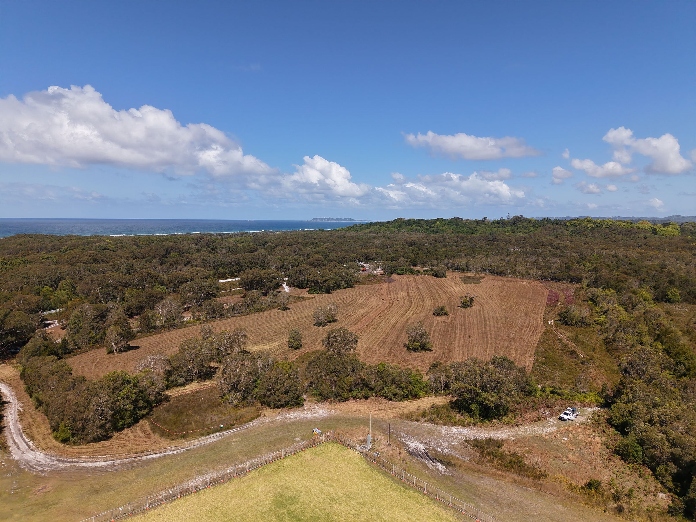
As Stage 1 works proceed at the Wallum site, and the sounds of slashers and mulchers ring out across Bayside, local activitsts who have been fighting to save the site from development are raising questions about compliance with the approved plans, and say discrepancies around consent conditions remain unanswered.
‘This is important on many levels, but primarily because in the federal case, Justice Perry placed weight on the approved management plans, describing them as an “adaptive and enforceable management regime” whose compliance requirements are “not merely aspirational”. Those plans formed a significant part of the court’s assessment,’ explained a spokesperson for Save Wallum.
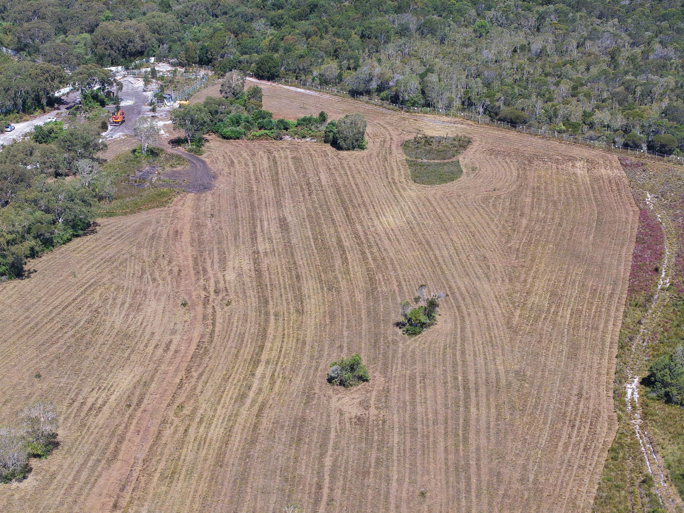
‘But what happens when the community identifies discrepancies between the approval conditions and later plans, and cannot get a clear explanation from Council or state agencies? Who is responsible for checking that the conditions are met and the plans the court relied on are actually followed?’
One issue concerns the stormwater, and a creek that runs through the middle of the site. Condition B4 required the existing north-south creek (which has been straightened to be used as a drain) to be retained with a Wallum froglet habitat and a riparian buffer generally 20 metres wide on each side. Stormwater facilities were generally to be kept out of that buffer. Condition B5 said the buffer (40m total), existing creek (approx 8m wide), and new stormwater drain were to become a public reserve.
‘Later engineering drawings show the existing north-south creek (drain) alongside the proposed new stormwater drainline and associated stormwater works. They do not mark the B4 buffer,’ explained the spokesperson.
Save Wallum has repeatedly asked Byron Shire Council to show where the mandatory buffer lies on the plans governing construction and how the proposed works comply.
‘Council sought legal advice about this B4 issue but has declined to release it, citing legal professional privilege. Save Wallum has seen an incomplete excerpt of that legal advice stating that “condition B4 and objective (b) of condition B9 were not satisfied”. What now?’
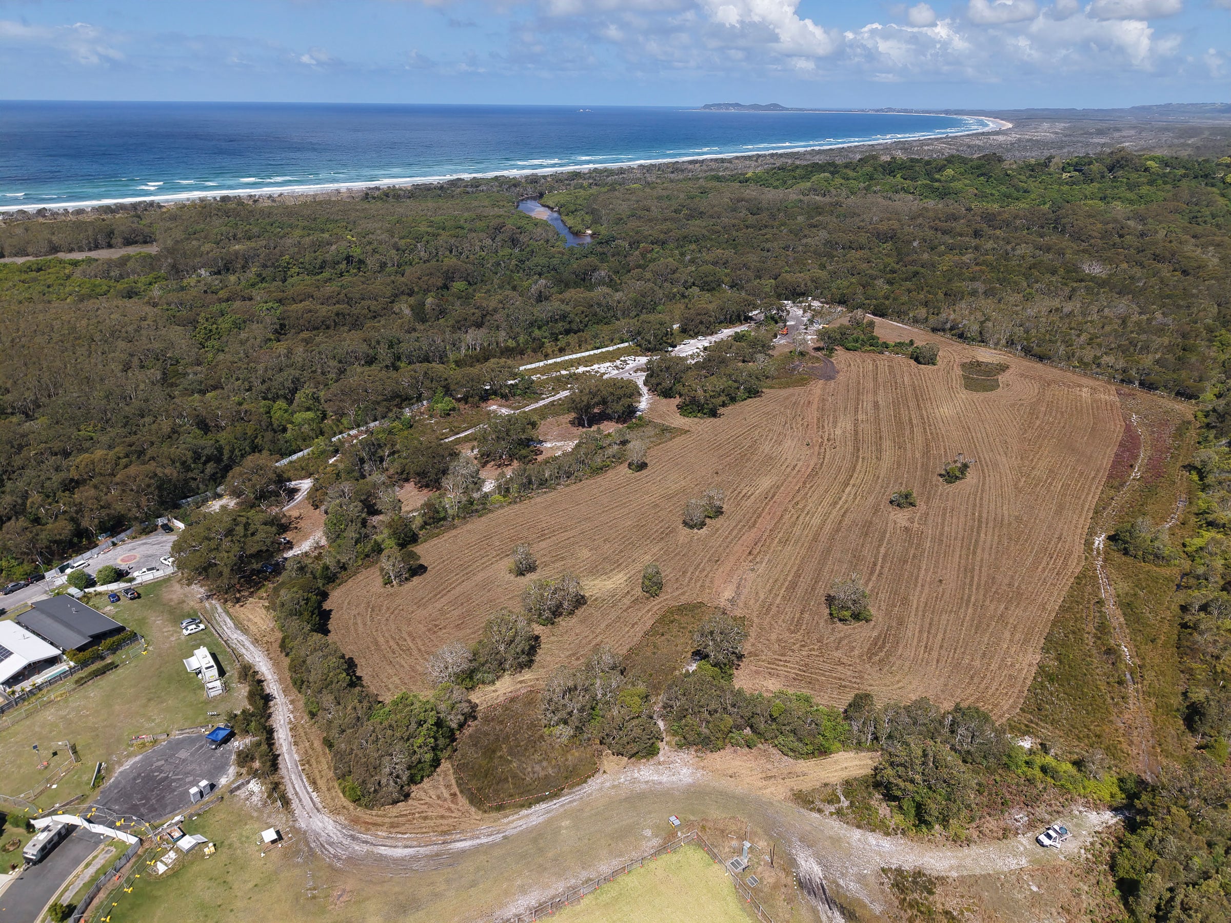
Wallum’s creekside public reserve disappears
‘Another anomaly needing explanation is the loss of a significant public reserve. The 2013 approved concept plan described a 10.24 hectares public reserve in the eastern part of the site, the part connected to Simpson Creek and Cape Byron Marine Park. Yet the Voluntary Planning Agreement (VPA) brought to Council by staff on 9 February 2023, shows that commitment is removed,’ say Save Wallum.
‘Getting answers has proved difficult. The NSW environment department directed a question about the reserve to the Planning Department’s Development Coordination Authority. That authority replied that land dedication was outside its role. The environment department also says it was last consulted on the vegetation and frog habitat plans in 2016 and has no record of being asked to comment on updated versions.
‘Works are underway. Council, state agencies and Clarence Property need to answer the questions the community has been asking including who is ensuring that the approval conditions and management plans the court placed weight on are actually followed?’ said Save Wallum
 For four decades The Echo has printed the stories some people loved, some people hated, and some pretended not to read. If you want us to keep telling the truth, the real truth, not the sugar-coated version. We’ll need your support to keep the presses rolling.