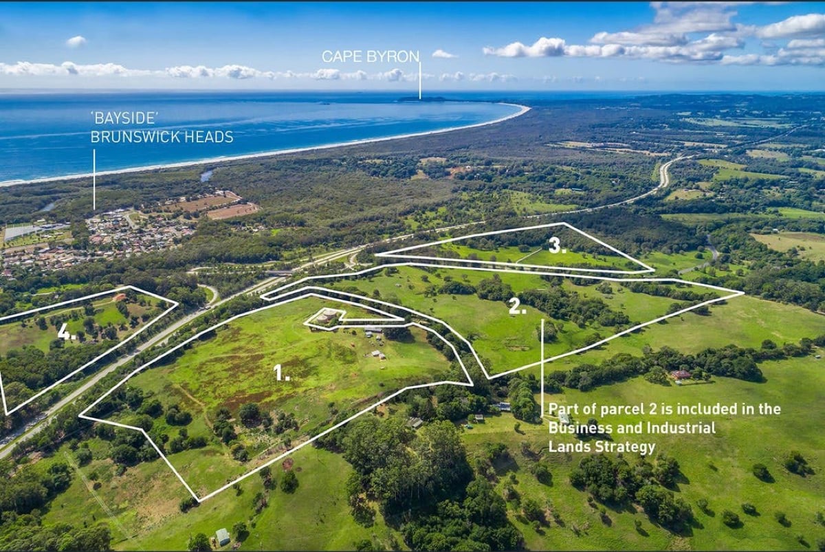
Byron Shire Council has signed off on a new planning blueprint that will transform a 52-hectare rural site off Gulgan Road in Brunswick Heads into a mixed light industrial and ‘work/live’ precinct.
The site is part of 66 The Saddle Road at Brunswick Heads, a large greenfield site that is slated for major residential, industrial, and social housing developments over the next decade.
Under the newly adopted Development Control Plan (DCP), part of the site known as ‘Area 5’ is set to become home to a clustered network of businesses, studios, and light industry, interspersed with housing and surrounded by conservation areas.
The plan, adopted unanimously at Council’s 16 April meeting, sets the rules for how the land will be subdivided, built, and managed into the future.
The development has been framed by its proponents as a ‘vibrant and sustainable urban environment’ combining light industry, creative businesses, and small-scale commercial activity with integrated housing, where people can live and work on the same site.
The layout is divided into three main precincts: a ‘productivity support’ zone with studios, offices and attached dwellings; an artisanal hub for smaller-scale makers and creative industries; and a more conventional light industrial area catering to uses ranging from food production to vehicle repair and warehousing.
Surrounding these is a fourth precinct made up of conservation land, designed to protect existing rainforest patches, waterways, and wildlife habitat, while buffering the development from neighbouring properties.
The proposal is presented as an attempt to blend industry with ecology and community, with documents outlining ambitions such as ‘carbon neutral operation’ and more efficient land and water use.
But when the draft plan went on public exhibition late last year, locals raised significant concerns.
Several submissions argued the proposal underestimated how many cars the development would generate, particularly given Byron’s limited public transport.
Concerns centred on the original suggestion that ‘work/live’ arrangements could justify reduced parking, with locals warning that employees, customers, and residents would all still need spaces.
Council staff ultimately conceded the point, scrapping references to reduced parking and revising the controls to increase provision.
Traffic and access were another key issue, especially fears that The Saddle Road – a narrow, semi-rural route – could become a de facto overflow or shortcut.
In response, the final plan states that there will be no vehicle access from The Saddle Road, with the main entry via Gulgan Road and additional design measures aimed at preventing spillover parking and informal connections.
There were also calls for stronger pedestrian and cycling infrastructure, tighter controls on domestic pets to protect wildlife, and greater recognition of the area’s Aboriginal cultural significance.
Each of these concerns appears to have been acknowledged in the final document, with new provisions for wildlife protection, cultural engagement, and improved walking and cycling links included in the DCP.
The Council’s decision to sign off on the DCP marks the latest chapter in what has been a long, and at times, contentious planning journey for The Saddle Road site, which has been earmarked for industrial and community use in various strategies and proposals dating back more than a decade.
Debate has ebbed and flowed over that time, often centring on the tension between the need for more employment land in the Shire and the desire to preserve the rural character and environmental values of The Saddle Road corridor.
With the planning framework now locked in, attention is likely to turn to the first development applications for the site.
 For four decades The Echo has printed the stories some people loved, some people hated, and some pretended not to read. If you want us to keep telling the truth, the real truth, not the sugar-coated version. We’ll need your support to keep the presses rolling.