By night, the nearby ICOLLs are creatures inhabiting my dreams. Intermittently Closed and Open Lake or Lagoon (ICOLL) is the proper name for the Richmond and the Brunswick, the Belongil and the Tallow waterways. In the dark tumult as well as in the shining heat of day, knowledge of a true name necessitates respect.
ICOLLs are characteristic of the New South Wales coast. These natural wonders are a dynamic composite of sea, land and freshwater.
As an inshore marine current endlessly heads north, it drags along sand that dreams of reaching K’gari, Paradise, the great island once called Fraser. Along the way, affected by geography, large amounts of sand drop out of the current and form great sand bars. These block freshwater that moves across the land down to the shore.
In this phase our ICOLLs appear as settled lakes or lagoons. They also include wetlands that swamp and swell with the rain, underground springs and our towns’ storm-water. They reach kilometres inland, lined with marshes, mangroves or forests. With the right combination of rain and tide, this phase changes. In phase two, the ICOLL sandbar shifts and re-connects with the sea. To varying degrees, the waterplaces drain.
Well trained
Of our four ICOLLs, the Richmond and the Brunswick, with their rock walls and spurs jutting out to sea, are considered ‘trained’. They seem like well-behaved rivers, always open to the sea.
But the inshore marine current continues to drop that endless sand. The result? The shape-shifting shoals and bars create at the mouth those well-known navigation hazards for ships and steamers.
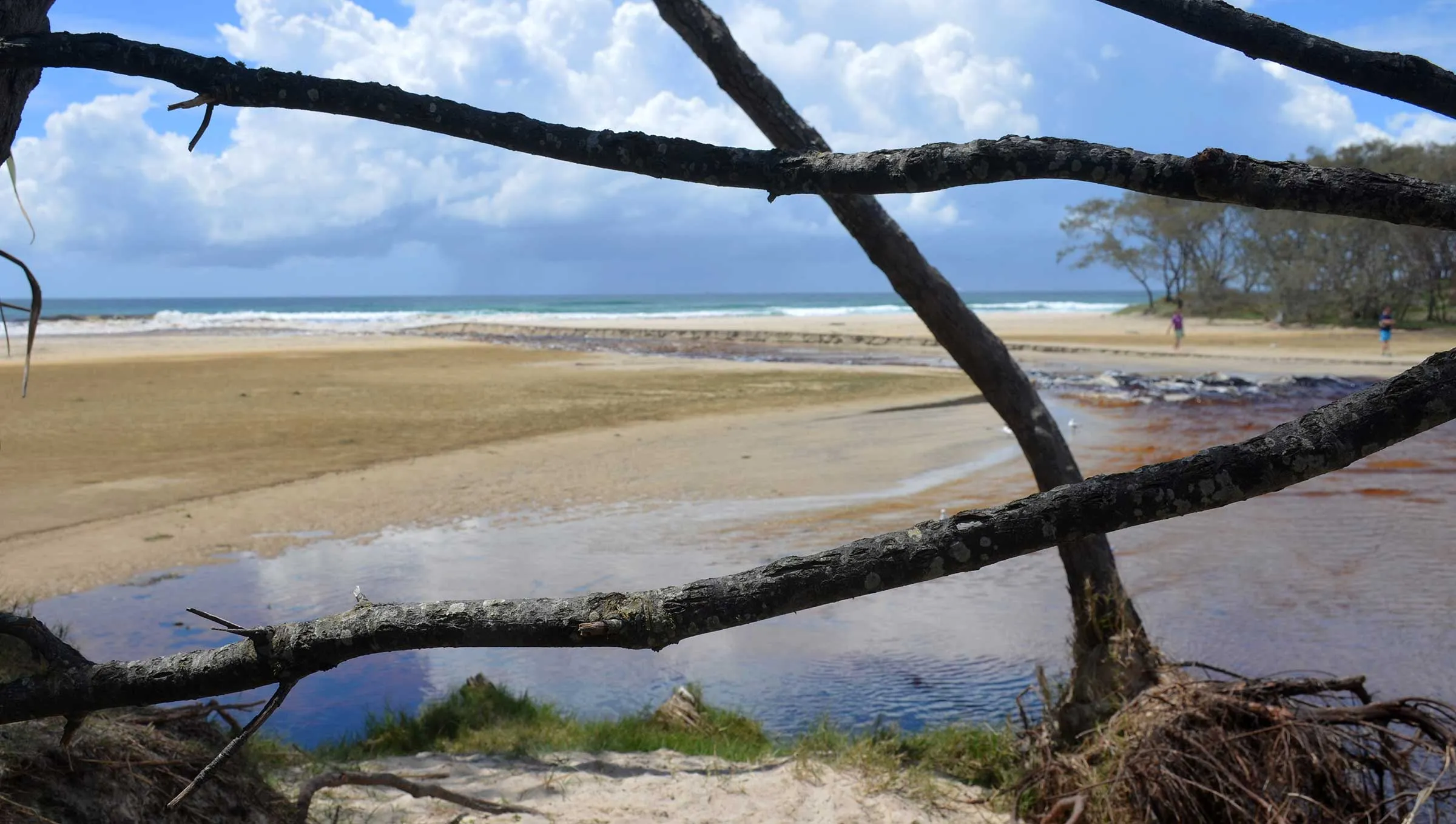
Only the Tallow and the Belongil ICOLLs are still free agents. Neither has rock walls. When it comes to opening to the sea, both have their own timings. Since the late 1800s, the mouth of Belongil was blocked off by residents from what is currently Don Street. Since 2005, the new mouth of the Belongil is often opened with heavy equipment by the Byron Shire Council. They act on a temporary licence from the state government.
The trigger for these works is the water at the end of the Butler Street drain near the railway. When it reaches a level of one metre, a trench is dug to open the Belongil ICOLL. For the sake of preserving the Cumbebin wetlands and wildlife, a trigger of 1.2 metres was recommended.
The Tallow has more freedom. The low-lying flat end is in Arakwal National Park. The other tendrils wind through Suffolk Park, Baywood Chase and Byron Hills. Recently, from early October, the drought broke while the sandbar at the mouth was high. So the ICOLL collected all that rain as well as receiving stormwater drainage from the entire catchment.
Tallow ICOLL, protected by a fishing ban, coddled its aquatic wildlife. Its bacteria, micro-algae and green water-weed also proliferated. The footings of the bridge near the old sewage ponds were submerged. So were fringing wetlands all the way to Broken Head Road. Their watery edges are shared with some private properties.
Byron Shire Council monitored the sandbar, as per the management regime agreed upon by Council, National Parks and community. Should the sandbar reach 2.2 metres above Australian mean sea level, the council would lower that bar by scraping it for 25 metres towards the south.

Specific timing
This work would be in late afternoon, before an incoming spring tide and preferably before rain. The sea would steadily overwhelm the sandbar, changing levels in the lower parts of the ICOLL without causing a breach. Different fish would either linger or venture out to sea. They’re known to travel, spawn, enter other ICOLLs and enhance other populations.
Some may say this careful agreement and watchfulness was undermined. Months of Tallow ICOLL productivity was wasted. Apparently, someone dug a trench perpendicular to the beach. Destablised, the sandbar broke open, rapidly draining the lagoon.
Over 23–24 November, the water level dropped more thana metre. Different people saw different things: very warm water, microbial blooms, the spread of black water. All are known factors causing de-oxygenation like this here which killed thousands of fish.
Bad design
This has happened before. But the council’s report about the Tallow is only about fixing drains. Bad stormwater designs cause flooding in Baywood Chase and Byron Hills. To floodproof Broken Head Road a bridge should replace the culverts near the BP service station. East of the road, the flooding in backyards was labelled ‘nuisance’ not ‘structural’. The only work suggested was raising the footbridge. Nowhere was there any mention of improving water quality and protecting fish.
Our Tallow ICOLL, andthe Belongil, are rare entities. Our town is built within them, on elevated sites or in drained ones. We must learn from them. The first step is using the true name for these waterplaces.
 For four decades The Echo has printed the stories some people loved, some people hated, and some pretended not to read. If you want us to keep telling the truth, the real truth, not the sugar-coated version. We’ll need your support to keep the presses rolling.