
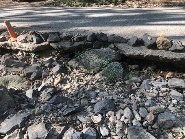
Disaster recovery funding of $52.5 million has been announced by the NSW Labor government, to help cash-strapped Byron Shire Council restore damaged rural road infrastructure.
Since the 2022 floods, many rural roads in the Byron Shire have received little, to no, maintenance, owing to Council being largely reliant on state and federal grants.
The NSW government media release says, ‘The funding, provided through the jointly-funded Disaster Recovery Funding Arrangements, will go towards restoring slopes at multiple locations and repairing the culvert at Coopers Lane [in Main Arm]’.
Given the scope of the works, they say it is expected to take ‘a number of years’ to complete.
Which landslips?
‘Funding received will be used to repair landslips on: Coolamon Scenic Drive (two locations), Left Bank Road (two locations), Wilsons Creek Road (three locations), Coopers Creek Road (two locations), Goonengerry Road, Frasers Road, The Pocket Road (three locations), Tristran Parade, Huonbrook Road (five locations), Johnsons Road (four locations), Dry Creek Road, Main Arm Road, Monet Drive, St Helena Road, Wanganui Road, and Possum Shoot Road.’

Build back better
Council’s Director of Infrastructure Services, Phil Holloway, confirmed that the funds announced are not attached to the Build Back Better program, whereby roads are not just rebuilt, but improved to withstand future extreme natural weather events.
While grateful that the state and federal governments ‘are finally coming through with the money for these essential repairs’, former councillor and spokesperson for the Coopers Lane Residents Association, Duncan Dey, told The Echo, ‘We don’t want it repaired, we want it made flood-ready’.
‘The additional cost to make it flood-ready is minor compared to the cost of this repair. And each future repair will cost the same as this repair because the culvert will still not be flood-ready.’

Phil Holloway, Director of Infrastructure Services, told The Echo, ‘The jointly-funded Disaster Recovery Funding Arrangements (NSW and federal government) guidelines indicate that eligible items can only be repaired to the same state they were prior to the flood event’.
He added, ‘While we don’t have the funds to complete the work they are proposing… Council will consult with the association further to investigate other funding options’.
Betterment projects
Mr Holloway added, ‘The only Betterment-funded projects Council currently planned are on Mullumbimby Road and some sections of Wilsons Creek Road’.
The Echo also asked Mr Holloway, ‘Given the road at Upper Main Arm is no longer recognised by Google Maps, when will Council be undertaking these essential roadworks?’
He replied, ‘Council received enquiries from concerned community members about increased road usage on this section of road, which is in poor condition’.
Misinterpretation
‘Owing to these concerns, Council requested assistance from Transport for NSW to contact Google and request that a note be put on this section of road for people to use caution. Unfortunately, there has been a misinterpretation somewhere and Google Maps is showing the road as closed. Council is working with Transport for NSW/Google to investigate and get this information corrected’.
Mr Holloway said, ‘The road is still open to local traffic, but road users should drive to conditions, and through traffic should avoid the area if possible’.
‘Work is due to begin shortly on Main Arm Road between Motts Road and Dry Creek Road to improve the road there. Maintenance work is also due to occur in late November/early December.
‘Signage has been placed in the area to recommend that the road only be used by local traffic in the interim’.
A full list of flood repair work is available at Byron Shire Council’s website.
 For four decades The Echo has printed the stories some people loved, some people hated, and some pretended not to read. If you want us to keep telling the truth, the real truth, not the sugar-coated version. We’ll need your support to keep the presses rolling.