Eric Freeman responded to the following questions from Echonetdaily
How do you respond to the claim that broken promises on your part have resulted in the boundaries of lots being drawn so as to encompass significant old growth trees, a number of which have since been felled by the private owners?
This “claim” does not state which lot, or lots, are referred to, so I am not able to determine what promise has been broken, if a promise was made, which I am not aware of. I am aware that there is one lot at the end of Laverty Court that had a large Brushbox tree that we protected by creating a Building Envelope for that lot outside of the area of the tree. That owner later appealed to Council that the tree was dangerous and should be removed and Council gave them permission and the tree was removed. We did not play any part in that approval or tree removal.
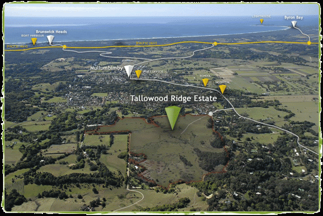
How do you respond to the claim that you have failed to allow public access to the ridge walk in any of the subdivision stages so far approved, and appear to have actively sought to prevent public access?
The “Friends of Mooibal Spur” know full well that the Tallowood Concept Plan approved in 2010 included a 2.5m wide concrete bikeway along the ridgeline and over to the Brushbox Drive cul de sac, so this claim is just a beatup.
In late 2011, Council engaged Biolink Koala Consultants to study the trees along the ridgeline for evidence of koala. Evidence of koala was found and then Council advised us that the bikeway to Brushbox Drive was cancelled and no points of access to the ridgeline were to be created.
Nonetheless, there are numerous points in Tallowood Ridge where the Public is able to access the ridgeline and we have not made any effort to prevent walkers from accessing the ridgeline, which is a 20m wide unmade Public Road Reserve in the care of Council—the ridgeline is not land owned by Tallowood Ridge.
How do you respond to the claim that you have failed to comply with the Biodiversity Conservation Management Plan ordered by the LEC, which required you to undertake 4 years of weed control and maintenance for zones 7a, 7b and 10?
In relation to Management Zones 7a, 7b and 10 (the forested areas in the southwest corner and along the ridgeline) the Biodiversity Conservation Management Plan does not require Tallowood Ridge to do any maintenance within these areas. Initially, the BCMP required us to fence off the forest to prevent cattle from entering, however, once the cattle were removed from the Tallowood site, this requirement was dropped.
How do you respond to the claim that you have not yet provided the requisite consent for an E2 zoning for either: 1) the areas marked for E2 zoning on the map prepared by Council staff in connection with the current DA applications, or 2) The areas you marked as E2 zones in a map emailed to FOMS representatives on April 29, 2019.
FOMS have worked themselves into a frenzy about preserving the entire forest area by zoning it E2 and have missed some fundamental points of this story:
- Actually, none of this forest meets the standards of Planning NSW for rezoning to E2, as E2 is reserved for areas of forest containing rare and endangered species of trees, which this forest does not.
- It has been my intention since commencing Tallowood Ridge that this forest be dedicated to Council as a Nature Reserve, but Council don’t want it due to the costs of maintenance and legal obligations under Rural Fire Service to maintain the forest in perpetuity, which is a very long time.
Because Council won’t take the land as a Nature Reserve, I have placed the forest area within the land proposed to be the Common Property of a Community Title part of Tallowood Ridge. This is an arrangement that assures
Rural Fire Service that the open grassland behind the Community Title residential lots will be maintained There will not be any development activity within the forested area other than as described in (3), (4) and (5) below. The boundaries of the Common Property can be viewed on plans submitted to Council with Tallowood Ridge Stage Nine.
- The Land and Environment Court required that a 40-metre wide firebreak be established in the open gully to protect the hundreds of homes in Tallowood Ridge from bushfire originating further to the west. Maintaining a cleared firebreak 40 metres wide does not fit with the E2 zone FOMS wants there. It will be rezoned E3.
- Within the area of the firebreak, the Court gave consent to construction of a Council drinking water trunk main with an access track for maintenance purposes.
- A number of Councillors made it clear to me that they want a 3m wide concrete accessway through the firebreak gully for bikes and pedestrians and, while we are at it, let’s make it an emergency vehicle road, which, again, does not fit with definition of E2, so that gully will be rezoned E3 or E4.
- Notwithstanding all of the above, I have cooperated with Council on rezoning large areas of the forest as E2 and the rezoning of those areas to be road / bikeway, firebreak and water main to E3 zone. Maps produced by Council of what is to be E2 and what is to be E3 continue to change along the western boundary of the Tallowood Ridge site, but we are almost there!
Do you intend to formally consent to either of these E2 zones?
Yes, when the boundaries between E2 and E3 are settled with Council.
***************************
Byron Council’s response
The Tallowood Estate has multiple development consents that apply to numerous stages that have been constructed, that are being constructed as well as stages currently being assessed by Council.
Each development application that has been approved via either the Land and Environment Court (LEC) or, more recently, by Council, has specific conditions that must be complied with.
Development applications received are considered on individual merits, and in relation to the original masterplan approval by the LEC, as well as current State and local legislation (planning and environment) as well as site context.
Non-compliance with conditions of consent or applicable State and local legislation is subject to enforcement investigation and action where deemed necessary.
Details of development applications and their status can be found on the Council’s DA tracker web page.
Separate to this is the E zone review process currently being progressed via multiple planning proposals.
Land at Tallowood is to be included in the stage 3 E zone planning proposal which is yet to be reported to Council for consideration. It should be noted that lands need to meet the criteria for E zoning as established by the State Government subject to discussions with the relevant land owner. At this time staff are continuing to review (and respond to) feedback from affected landowners to be included in the Stage 3 Planning Proposal.
Council has received no recent complaints about unauthorised tree removal.
 For four decades The Echo has printed the stories some people loved, some people hated, and some pretended not to read. If you want us to keep telling the truth, the real truth, not the sugar-coated version. We’ll need your support to keep the presses rolling.